
IMAGES TAKEN NEAR TO
Taylor Avenue, NEWCASTLE UPON TYNE, NE13 6NB
Introduction
This page details the photographs taken nearby to Taylor Avenue, NE13 6NB by members of the Geograph project.
The Geograph project started in 2005 with the aim of publishing, organising and preserving representative images for every square kilometre of Great Britain, Ireland and the Isle of Man.

There are currently over 7.5m images from over14,400 individuals and you can help contribute to the project by visiting https://www.geograph.org.uk
Image Map
Images are licensed for reuse under creativecommons.org/licenses/by-sa/2.0
Notes
- Clicking on the map will re-center to the selected point.
- The higher the marker number, the further away the image location is from the centre of the postcode.
Image Listing (18 Images Found)
Images are licensed for reuse under creativecommons.org/licenses/by-sa/2.0
Image
Details
Distance
1
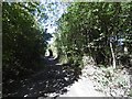
Seatonburn Waggonway
Now a cycle path, the railway was shown as open on the 1976 1:50,000 map and disused on the 1981 edition.
Image: © Richard Webb
Taken: 1 Oct 2015
0.13 miles
2
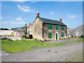
Boarded farmhouse at East Wideopen
East Wideopen is a farm lying just to the east of Wideopen. The house is boarded and the buildings fenced around for security but the property is apparently in good order (June 2015) and not abandoned.
Image: © Trevor Littlewood
Taken: 30 Jun 2015
0.13 miles
4
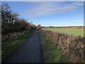
Seatonburn Waggonway
Former waggonway and later railway serving Seaton Burn colliery. The line connected with the Fawdon waggonway at Wideopen, taking coals from several collieries to the Tyne. This section of the route is now a bridleway.
Image: © David Robinson
Taken: 20 Jan 2022
0.17 miles
5
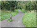
Public Bridleway, Wideopen
This public bridleway forms part of the Reivers Route, a 170-mile coast-to-coast cycle route from Tynemouth to Whitehaven which passes through unspoilt Northumberland, the Kielder Forest, Carlisle and the Lake District. At this point it is following the course of the former Seatonburn Waggonway. For a selection of detailed free to download walking routes in the area visit www.northtynesidewalks.co.uk
Image: © Geoff Holland
Taken: 5 Aug 2020
0.18 miles
6
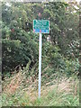
Sign, East Wideopen
This sign stands at the junction of two public bridleways, one which forms part of the Reivers Cycle Route, and the other which leads to nearby Lockey Park and the Great North Road in Wideopen. Behind the trees lies a new housing estate which stands on the site of the old East Wideopen Farm. For a selection of detailed free to download walking routes in the area visit www.northtynesidewalks.co.uk
Image: © Geoff Holland
Taken: 5 Aug 2020
0.19 miles
7
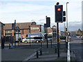
Traffic lights at the centre of Wideopen
Stalks Road comes in from the left to join North Road (formerly the A1, the Great North Road, now the B1318) in the centre of Wideopen. The Co-op, the largest shop in the village lies just beyond the traffic lights.
Image: © Oliver Dixon
Taken: 23 Feb 2012
0.19 miles
8
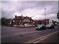
The Travellers Rest, Wide Open
A well known landmark pub on the road north from Newcastle. This was once the A1, The Great North Road, before the building of the motorway a short distance to the west.
Image: © Robert Graham
Taken: 28 Nov 2011
0.19 miles
9
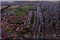
Wideopen
Wideopen, seen from the air.
Image: © Peter McDermott
Taken: 13 Nov 2008
0.19 miles
10
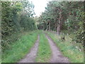
Track, East Wideopen
This track, which is not a public footpath, runs parallel with the public bridleway shown at https://www.geograph.org.uk/photo/6560434 and gives access to the narrow linear plantation lying between the two. For a selection of detailed free to download walking routes in the area visit www.northtynesidewalks.co.uk
Image: © Geoff Holland
Taken: 5 Aug 2020
0.19 miles