IMAGES TAKEN NEAR TO
Throwley, FAVERSHAM, ME13 0JU
Introduction
This page details the photographs taken nearby to ME13 0JU by members of the Geograph project.
The Geograph project started in 2005 with the aim of publishing, organising and preserving representative images for every square kilometre of Great Britain, Ireland and the Isle of Man.

There are currently over 7.5m images from over14,400 individuals and you can help contribute to the project by visiting https://www.geograph.org.uk
Image Map
Images are licensed for reuse under creativecommons.org/licenses/by-sa/2.0
Notes
- Clicking on the map will re-center to the selected point.
- The higher the marker number, the further away the image location is from the centre of the postcode.
Image Listing (11 Images Found)
Images are licensed for reuse under creativecommons.org/licenses/by-sa/2.0
Image
Details
Distance
1
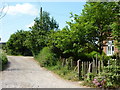
Track leading to Broomfield Farm
Viewed from Broomfield Lane.
Image: © pam fray
Taken: 20 May 2011
0.00 miles
2
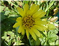
Goatsbeard flower
At the edge of Broomfield Lane.
Image: © pam fray
Taken: 20 May 2011
0.07 miles
3
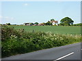
Broomfield Farm near Leaveland
Viewed from Broomfield Lane.
Image: © pam fray
Taken: 20 May 2011
0.12 miles
4
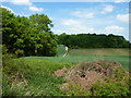
View of Birchetts Wood
Seen from Broomfield Lane. The edge of Jeffrys Bank Wood is to the left.
Image: © pam fray
Taken: 20 May 2011
0.13 miles
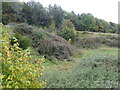
5
Part of Jeffrys Bank Wood
Viewed from Broomfield Lane near the junction with Loose Down Road.
Image: © pam fray
Taken: 20 May 2011
0.14 miles
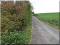
6
Loose Down Road
Junction with Broomfield Lane. The road leads to Bell's Forstal and Throwley Forstal.
Image: © pam fray
Taken: 20 May 2011
0.20 miles
7
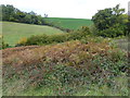
View from Footpath to Broomfield Farm
On the map a footpath is marked from Faversham Road to Broomfield Farm, but the footpath sign is very hard to find as is the footpath itself. Only a slightly trampled track in the grass indicates its route. This view looks across Faversham Road to Loose Down Road which rises up on the other side of the hedge to the right of the sloping field.
Image: © Marathon
Taken: 13 Oct 2017
0.20 miles
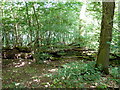
8
Old quarry near Broomfield Farm
On the map a footpath is marked from Faversham Road to Broomfield Farm, but the footpath sign is very hard to find as is the footpath itself. Only a slightly trampled track in the grass indicates its route. A little way after leaving Faversham Road it passes the remains of a very small quarry which is now very overgrown.
Image: © Marathon
Taken: 13 Oct 2017
0.21 miles
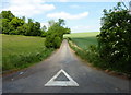
9
Loose Down Road
This is the view from the junction with Faversham Road. Loose Downs Road leads to Bell's Forstal.
Image: © Marathon
Taken: 13 Oct 2017
0.21 miles
10
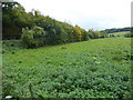
Field alongside Faversham Road
This is the view from near the junction of Loose Down Road with Faversham Road. Faversham Road is to the left of the hedge. Hurst Wood is on the right horizon.
Image: © Marathon
Taken: 13 Oct 2017
0.22 miles