IMAGES TAKEN NEAR TO
Lower Road, SHEERNESS, ME12 3SR
Introduction
This page details the photographs taken nearby to Lower Road, ME12 3SR by members of the Geograph project.
The Geograph project started in 2005 with the aim of publishing, organising and preserving representative images for every square kilometre of Great Britain, Ireland and the Isle of Man.

There are currently over 7.5m images from over14,400 individuals and you can help contribute to the project by visiting https://www.geograph.org.uk
Image Map
Images are licensed for reuse under creativecommons.org/licenses/by-sa/2.0
Notes
- Clicking on the map will re-center to the selected point.
- The higher the marker number, the further away the image location is from the centre of the postcode.
Image Listing (20 Images Found)
Images are licensed for reuse under creativecommons.org/licenses/by-sa/2.0
Image
Details
Distance
1
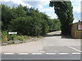
Elmley Road meets B2231 Lower Road
Elmley Road is an access road to several farms and also a bridleway to Poors Farm and Southlees Marshes.
Image: © David Anstiss
Taken: 10 Jul 2009
0.02 miles
5
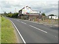
Elm Tree Inn, Lower Road, Brambledown
Still up for sale through Porters estate agency, whose board can be seen beside the road. It is currently on the market for £450,000 http://www.porterssurveyors.co.uk/freehold.htm Several companies have used this wall to advertise their businesses, including Minster Aerials Ltd. It does appear that The Elm Tree Inn has been on the market for many years http://www.rightmove.co.uk/house-prices/detailMatching.html/svr/2704;jsessionid=58717B43D9499F20E18FB0344D4AB00C?prop=17181835&sale=22039892&country=england
Image: © John Baker
Taken: 22 Aug 2012
0.11 miles
6
Elm Tree Inn, near Brambledown, Sheppey
Image: © Chris Whippet
Taken: 17 Jul 2009
0.12 miles
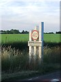
7
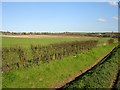
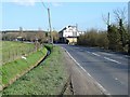
Farmland north of Lower Road
Lower Road is the main West - East route on the island (avoiding Minster). The land falls steadily from the north to the marshland south of the road.
Image: © Penny Mayes
Taken: 8 Mar 2007
0.12 miles
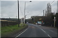
8
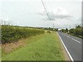
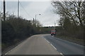
Lower Road (B2231), Brambledown
In the distance is Image
Image: © John Baker
Taken: 22 Aug 2012
0.13 miles
10
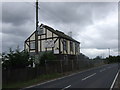
The Elm Tree
A disused pub on the Lower Road.
Image: © Penny Mayes
Taken: 8 Mar 2007
0.13 miles