IMAGES TAKEN NEAR TO
Barton Hill Drive, SHEERNESS, ME12 3LY
Introduction
This page details the photographs taken nearby to Barton Hill Drive, ME12 3LY by members of the Geograph project.
The Geograph project started in 2005 with the aim of publishing, organising and preserving representative images for every square kilometre of Great Britain, Ireland and the Isle of Man.

There are currently over 7.5m images from over14,400 individuals and you can help contribute to the project by visiting https://www.geograph.org.uk
Image Map
Images are licensed for reuse under creativecommons.org/licenses/by-sa/2.0
Notes
- Clicking on the map will re-center to the selected point.
- The higher the marker number, the further away the image location is from the centre of the postcode.
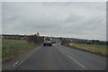
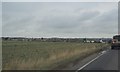
Image Listing (10 Images Found)
Images are licensed for reuse under creativecommons.org/licenses/by-sa/2.0
Image
Details
Distance

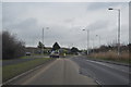
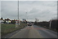
2
Traffic lights on Lower Road (B2231)
At the junction with Barton Hill Drive (to the right). Hopefully the field beyond will be kept for agriculture and not engulfed by another large housing development.
Image: © John Baker
Taken: 7 Oct 2012
0.07 miles
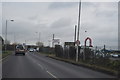
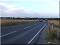
7
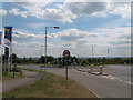
Roundabout on B2231 Lower Road
Thistle Hill Way from Minster leads through a new large housing estate to reach the Lower Road, which heads right to Eastchurch and Leysdown, or left to A249 Sheppey Way and Queenborough.
Image: © David Anstiss
Taken: 10 Jul 2009
0.21 miles