
IMAGES TAKEN NEAR TO
Mentmore, LEIGHTON BUZZARD, LU7 0QE
Introduction
This page details the photographs taken nearby to LU7 0QE by members of the Geograph project.
The Geograph project started in 2005 with the aim of publishing, organising and preserving representative images for every square kilometre of Great Britain, Ireland and the Isle of Man.

There are currently over 7.5m images from over14,400 individuals and you can help contribute to the project by visiting https://www.geograph.org.uk
Image Map
Images are licensed for reuse under creativecommons.org/licenses/by-sa/2.0
Notes
- Clicking on the map will re-center to the selected point.
- The higher the marker number, the further away the image location is from the centre of the postcode.
Image Listing (34 Images Found)
Images are licensed for reuse under creativecommons.org/licenses/by-sa/2.0
Image
Details
Distance
1
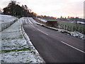
Mentmore
The country lane leading into Mentmore village from the north viewed looking southwards with a light dusting of snow on the ground.
Image: © Nigel Cox
Taken: 28 Dec 2005
0.03 miles
2
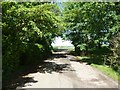
Mentmore - The Green lane northern end
This is the end of the lane which loops around The Green in Mentmore and is named after it. This is its northern end as it comes to a T-junction with the lane to Ledburn.
Image: © Rob Farrow
Taken: 25 May 2014
0.05 miles
3
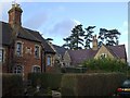
Mentmore - village houses
Mentmore is an estate village formerly belonging to the mansion of Mentmore Towers (see other photos for this square). Just about all the houses in this village are picturesque, the ones shown here & Image] being typical, though unlike many estate villages the houses are quite varied in design.
Image: © Rob Farrow
Taken: 21 Jan 2007
0.07 miles
4
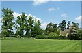
Mentmore - northern end of The Green
Mentmore is a charming village which owes much of its existence to the neighbouring Mentmore Towers (see Image]) as many of the houses were built for estate workers. In the centre of the village is The Green, which is fringed by some mighty trees on its border with the lane to Ledburn (see Image]) four of which can be seen on the left in this image. This is a view of the northern part of The Green. The photo was taken from the village street which runs along The Green's southeastern side, and is also called The Green.
Image: © Rob Farrow
Taken: 17 May 2014
0.09 miles
5
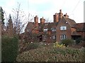
Houses in Mentmore village
Mentmore is an estate village formerly belonging to the mansion of Mentmore Towers (see other photos for this square). Just about all the houses in this village are picturesque, the ones shown here & Image] being typical, though unlike many estate villages the houses are quite varied in design.
Image: © Rob Farrow
Taken: 21 Jan 2007
0.09 miles
7
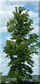
Tall lime tree
There is a fine row of lime trees along the boundary of The Green in Mentmore where it borders the lane to Ledburn (see Image] and Image]) the first few of these limes are rounded-topped, broad and of medium height, whereas the more northerly ones are taller and slimmer, such as the one seen here.
Image: © Rob Farrow
Taken: 25 May 2014
0.11 miles
8
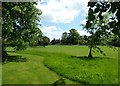
Mentmore - view across The Green
A view across The Green in Mentmore from the Lane to Ledburn.
Image: © Rob Farrow
Taken: 25 May 2014
0.11 miles
9
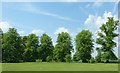
Mentmore trees
This magnificent row of trees - which are all limes (Tilia genus) fringes the road out of Mentmore to Ledburn bordering the green in the centre of the village. See also Image]
To see this row of trees from a different direction - and in very different weather conditions, see Image] taken 7½ years ago.
Image: © Rob Farrow
Taken: 17 May 2014
0.12 miles
10
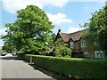
Mentmore - A house on The Green
This is one of the row of houses along the village street called The Green which borders the village green of the same name on the southeastern side.
See also Image] and Image]
Image: © Rob Farrow
Taken: 17 May 2014
0.12 miles