
IMAGES TAKEN NEAR TO
Moor Top, OTLEY, LS21 3DH
Introduction
This page details the photographs taken nearby to Moor Top, LS21 3DH by members of the Geograph project.
The Geograph project started in 2005 with the aim of publishing, organising and preserving representative images for every square kilometre of Great Britain, Ireland and the Isle of Man.

There are currently over 7.5m images from over14,400 individuals and you can help contribute to the project by visiting https://www.geograph.org.uk
Image Map
Images are licensed for reuse under creativecommons.org/licenses/by-sa/2.0
Notes
- Clicking on the map will re-center to the selected point.
- The higher the marker number, the further away the image location is from the centre of the postcode.
Image Listing (11 Images Found)
Images are licensed for reuse under creativecommons.org/licenses/by-sa/2.0
Image
Details
Distance
2
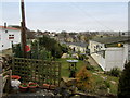
Chevin Park Camping Site
Seems to contain some more permanent structures, besides caravans and tents - here on the West Chevin.
Image: © Chris Heaton
Taken: 1 Mar 2013
0.10 miles
3
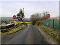
On a Lane called Moor Top
Moor Top, beside the Chevin Park Camping Site as it descends to meet West Chevin Road.
Image: © Chris Heaton
Taken: 1 Mar 2013
0.11 miles
4
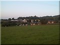
West Chevin
Both the caravan park and the cattle in the field below are lit by the evening sun.
Image: © Michael Dibb
Taken: 20 May 2011
0.14 miles
5

Farmers' track to West Chevin Farm
Off York Gate, the track has an unmarked footpath to its left in this view.
Image: © Kevin Waterhouse
Taken: 7 Aug 2025
0.16 miles
6
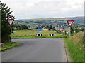
York Gate at its junction with Moor Top
Looking westward.
Image: © Peter Wood
Taken: 1 Aug 2017
0.19 miles
7
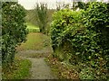
Old bridge abutments
The path that now joins the former route of the Bramhope to Ilkley railway line once crossed the railway by a footbridge, of which only these stone abutments remain.
Image: © Stephen Craven
Taken: 22 Nov 2020
0.21 miles
8
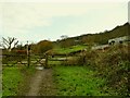
Low Pasture
The name is that of the farm to the right. The access road crosses the old railway line between Otley and Ilkley. The property doesn't appear on the 1956 map, and the railway closed in 1965, so there was presumably no level crossing here when it was open.
Image: © Stephen Craven
Taken: 22 Nov 2020
0.21 miles
10
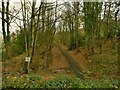
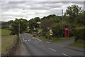
Former railway route, looking towards Otley
This was the Ilkley to Bramhope railway line that closed to passengers in 1965.
Image: © Stephen Craven
Taken: 22 Nov 2020
0.22 miles