
IMAGES TAKEN NEAR TO
Trem Y Ffridd, BALA, LL23 7DG
Introduction
This page details the photographs taken nearby to Trem Y Ffridd, LL23 7DG by members of the Geograph project.
The Geograph project started in 2005 with the aim of publishing, organising and preserving representative images for every square kilometre of Great Britain, Ireland and the Isle of Man.

There are currently over 7.5m images from over14,400 individuals and you can help contribute to the project by visiting https://www.geograph.org.uk
Image Map
Images are licensed for reuse under creativecommons.org/licenses/by-sa/2.0
Notes
- Clicking on the map will re-center to the selected point.
- The higher the marker number, the further away the image location is from the centre of the postcode.
Image Listing (108 Images Found)
Images are licensed for reuse under creativecommons.org/licenses/by-sa/2.0
Image
Details
Distance
2
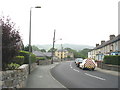
Lower Tegid Street with housing representative of three centuries
The bungalows on the left hand side are a product of the 21st century, the houses opposite date from the Edwardian period and the large yellow building in the background dates back to the 18th century.
Image: © Eric Jones
Taken: 8 Jun 2007
0.06 miles
3
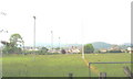
Cae Clwb Rygbi Y Bala Rugby Club Ground, Tegid Street
Image: © Eric Jones
Taken: 8 Jun 2007
0.07 miles
4
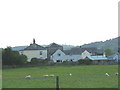
Maes-yr-hedydd from the Bala by-pass
Until the late 20th century, the gentleman's residence of Maes yr Hedydd (lark's field) and its adjoining farmhouse, lay well outside the boundaries of the town of Bala. Since then it has been almost surrounded by new housing and road developments.
Image: © Eric Jones
Taken: 8 Jun 2007
0.07 miles
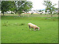
6
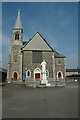
Capel Tegid y Bala
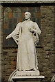
Here is Thomas Charles.The story goes that a young girl called Mary Jones walked many miles to receive a Bible but on arrival all had gone, it is said that Thomas Charles gave Mary his own Bible as a gift for her sheer determination and faith.
Image: © Graeme Walker
Taken: 2 Apr 2007
0.12 miles
8
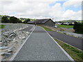
Bala Lake Railway extension, Bala
In Spring 2023, work on a new flood defence at the end of Llyn Tegid (Bala Lake) was completed. The work included providing a trackbed for the proposed extension of the Bala Lake Railway into the centre of Bala.
The path alongside the railway trackbed is on a loop of the Cross Britain Way long distance path into the centre of Bala. The town is situated on the edge of Snowdonia National Park.
Image: © Malc McDonald
Taken: 11 Aug 2023
0.13 miles
9
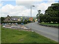
Heol Tegid (Tegid Street), Bala
Heol Tegid (Tegid Street in the English language) is a minor road in the town of Bala, in Snowdonia National Park. This road used to form the route of the B4391 into the town, but the B road now follows a newer road which avoids the heart of Bala. Heol Tegid is on a loop of the Cross Britain Way long distance path, taking the path into the centre of Bala.
Beside the road is a newly-built seating area.
Image: © Malc McDonald
Taken: 11 Aug 2023
0.14 miles
10
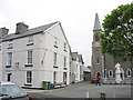
The Bala Backpackers Hostel, Tegid Square
A friendly independent hostel very conveniently located less than two minutes from Bala High Street and overlooking the pleasant Tegid Chapel Square with its statue of the Rev. Thomas Charles. Catering for individuals, families and groups, the hostel is conveniently located for a variety of outdoor activities, especially walking, sailing and white water rafting. This is my base for walking in this part of mid-Wales and it provides easy access to the Berwyn, Hirnant, Arenig, Aran and Cadair Idris ranges. In the early 1800s the building housed the Calvinistic Methodist seminary.
http://www.bala-backpackers.co.uk
Image: © Eric Jones
Taken: 8 Jun 2007
0.15 miles