Bala Lake Railway extension, Bala
Introduction
The photograph on this page of Bala Lake Railway extension, Bala by Malc McDonald as part of the Geograph project.
The Geograph project started in 2005 with the aim of publishing, organising and preserving representative images for every square kilometre of Great Britain, Ireland and the Isle of Man.

There are currently over 7.5m images from over 14,400 individuals and you can help contribute to the project by visiting https://www.geograph.org.uk
Bala Lake Railway extension, Bala
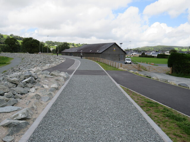
Image: © Malc McDonald Taken: 11 Aug 2023
In Spring 2023, work on a new flood defence at the end of Llyn Tegid (Bala Lake) was completed. The work included providing a trackbed for the proposed extension of the Bala Lake Railway into the centre of Bala. The path alongside the railway trackbed is on a loop of the Cross Britain Way long distance path into the centre of Bala. The town is situated on the edge of Snowdonia National Park.
Images are licensed for reuse under creativecommons.org/licenses/by-sa/2.0
Image Location


Leaflet Map data © OpenStreetMap
Latitude
52.905488
Longitude
-3.595196