1
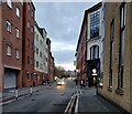
Grange Lane in Leicester
A city centre street lined with student accommodation blocks and a Rileys Sports Bar.
Image: © Mat Fascione
Taken: 27 Feb 2023
0.03 miles
2
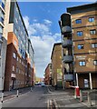
Mill Lane in Leicester
The building on the right is the Campus Centre of the De Montfort University.
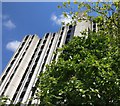
The tall building in the centre is one of the two towers at the New Walk Centre, the former home of Leicester City Council. It has been stripped down to a concrete shell in preparation for its demolition. 22 hours after this photo was taken, it was blown up and reduced to a pile of rubble.
Image: © Mat Fascione
Taken: 21 Feb 2015
0.03 miles
3
Bonners Lane in Leicester
At the campus of De Montfort University Leicester.
Image: © Mat Fascione
Taken: 27 May 2017
0.03 miles
4
The Swan and Rushes, Leicester
After being empty for a year, the pub re-opened in 2018 with a modernised interior, but keeping the older, traditional facade. On its left, new student accommodation. Leicester architecture is a mixture of older, ugly 1960-70s high rise, and uninspiring modern buildings.
Image: © Tim Heaton
Taken: 13 Aug 2019
0.03 miles
5
Grange Lane in Leicester
A city centre street, mainly lined with student accommodation blocks.
Image: © Mat Fascione
Taken: 12 Apr 2021
0.04 miles
6
Leicester - LE1
This building sitting at the junction of Bonners Lane with Oxford Street may have been a hosiery manufacturing factory in the past? Now however, it is part of the De Montfort University campus.
Image: © David Hallam-Jones
Taken: 31 Mar 2012
0.04 miles
7
Bonners Lane and Clephan Building, De Montfort University
Looking towards Oxford Street.
Image: © Richard Vince
Taken: 15 Jun 2013
0.05 miles
8
De Montfort House in Leicester
Image: © Mat Fascione
Taken: 13 May 2019
0.05 miles
9
Leicester - LE1
A multi-storey block of flats on Oxford Street in the Southfields area - near to the Royal Infirmary - overshadows the remains of an old doorway or gateway leading into a communal open-space/turfed area.
Image: © David Hallam-Jones
Taken: 31 Mar 2012
0.05 miles
10
Former gateway, Oxford Street, Leicester
Originally the entrance to J.E. Pickard's Spinning Mill, built in the 1870s and demolished a century later.
It now stands before this building
Image
Image: © Stephen Richards
Taken: 24 Aug 2011
0.05 miles


