IMAGES TAKEN NEAR TO
Gwenddwr, BUILTH WELLS, LD2 3LQ

Introduction

This page details the photographs taken nearby to LD2 3LQ by members of the Geograph project.

The Geograph project started in 2005 with the aim of publishing, organising and preserving representative images for every square kilometre of Great Britain, Ireland and the Isle of Man.

There are currently over 7.5m images from over14,400 individuals and you can help contribute to the project by visiting https://www.geograph.org.uk

Image Map


Images are licensed for reuse under creativecommons.org/licenses/by-sa/2.0
Notes
  • Clicking on the map will re-center to the selected point.
  • The higher the marker number, the further away the image location is from the centre of the postcode.

Image Listing (8 Images Found)

Images are licensed for reuse under creativecommons.org/licenses/by-sa/2.0
Image
Details
Distance
1
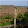
Footpath sign by lane with view across the Wye valley
The lane serves a series of farms set high up on the western slopes of the valley. The path goes to Erw'rhenallt, a farm above the lane in the next square south. Glow and shadows of evening light.
Image: © Andrew Hill Taken: 7 May 2018
0.11 miles
2
Getting closer to the Wye
The minor road to the west of the Wye descends through three miles, gradually getting closer to the river. Here, although the river is still not visible, you get the impression you are in a valley rather than on a hillside.
Image: © Graham Horn Taken: 24 Jan 2008
0.13 miles
3
Pasture set above the Wye valley
The pasture lies between the lane and the farm drive to Pentwyn. Beyond the trees the ground falls away more steeply to the valley. The hillside around Aberedw Rocks can be seen opposite.
Image: © Andrew Hill Taken: 7 May 2018
0.14 miles
4
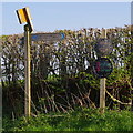
Signs for footpaths and farms
The Wye Valley walk passes high up the hillside near Bedw Farm on the way north to Builth Wells. Downhill to cross the river north of Erwood in the other direction.
Image: © Andrew Hill Taken: 7 May 2018
0.14 miles
5
View across lane above the Wye Valley
Beyond the field and trees the river flows from right to left much further down. The village across the valley left of centre is Aberedw.
Image: © Andrew Hill Taken: 7 May 2018
0.14 miles
6
Entrance to Lower Pentwyn
As the slope to the east (right) gets steeper towards the river Wye the fields get smaller and more difficult to use. This one is still sheep pasture but a row of trees has been planted and one wonders if it is intended to make this an orchard.
Image: © Graham Horn Taken: 24 Jan 2008
0.15 miles
7
Above the River Wye
At this point the Wye Valley Walk follows a minor road for about 2 kilometres. The pronounced top in the distance is Twmpa (Lord Hereford's Knob).
Image: © David Purchase Taken: 12 May 2012
0.18 miles
8
Hillside lane towards Hendy
Hendy is the next farm (out of picture to the right) on the hillside rising to the west of the Wye valley. Mainly improved pasture for sheep, with open hill on the skyline.
Image: © Andrew Hill Taken: 7 May 2018
0.21 miles