IMAGES TAKEN NEAR TO
Church Road, WOODBRIDGE, IP12 3AE

Introduction

This page details the photographs taken nearby to Church Road, IP12 3AE by members of the Geograph project.

The Geograph project started in 2005 with the aim of publishing, organising and preserving representative images for every square kilometre of Great Britain, Ireland and the Isle of Man.

There are currently over 7.5m images from over14,400 individuals and you can help contribute to the project by visiting https://www.geograph.org.uk

Image Map


Images are licensed for reuse under creativecommons.org/licenses/by-sa/2.0
Notes
  • Clicking on the map will re-center to the selected point.
  • The higher the marker number, the further away the image location is from the centre of the postcode.

Image Listing (18 Images Found)

Images are licensed for reuse under creativecommons.org/licenses/by-sa/2.0
Image
Details
Distance
1
Ramsholt, Suffolk
A tiny hamlet of just a few houses. Compare with this shot taken 11 years previously Image, not much has changed. The largest building is the old school, which was in use until 1927: Image
Image: © Chris Holifield Taken: 16 Apr 2017
0.01 miles
2
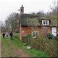
Cottage in Ramsholt
Image: © Chris Holifield Taken: 7 Jul 2012
0.01 miles
3
Ramsholt: a Boxing Day walk past Valley Cottage
We were making our way to the church, which stands apart from what remains of this remote village on the Bawdsey peninsula.
Image: © John Sutton Taken: 26 Dec 2018
0.01 miles
4
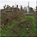
Ramsholt: uphill to Valley Cottage and The Old School House
The school's heyday was before the Great War - it closed in 1927. These are some of the few houses in what is now a tiny and remote hamlet on the Bawdsey peninsula.
Image: © John Sutton Taken: 26 Dec 2018
0.01 miles
5
The Old School, Ramsholt
This was in use as a school until 1927 http://www.btinternet.com/~anderton/starwalk/ramsholt.htm
Image: © Chris Holifield Taken: 30 Jun 2012
0.02 miles
6
Ramsholt: bridle ways and The Old School House
The school's heyday was before the Great War - it closed in 1927. The village has dwindled further since then.
Image: © John Sutton Taken: 26 Dec 2018
0.03 miles
7
Ramsholt, Suffolk
This hamlet consists of a few houses and farms. The large building in the centre is the old schoolhouse, which indicates that in the past, this was a much large settlement.
Image: © John Winfield Taken: 29 Oct 2005
0.06 miles
8
Ramsholt: towards the river
A reedy inlet of the Deben, seen from the path from Dock Road to Valley Farm on the cloudy morning of Boxing Day.
Image: © John Sutton Taken: 26 Dec 2018
0.09 miles
9
Track in Ramsholt
This track leads from Church Lane down to the few buildings around the old School House in Ramsholt
Image: © Chris Holifield Taken: 30 Jun 2012
0.14 miles
10
Bridleway near Ramsholt
Image: © Dave Thompson Taken: 26 Jul 2021
0.16 miles