
IMAGES TAKEN NEAR TO
Roden Street, ILFORD, IG1 2AQ
Introduction
This page details the photographs taken nearby to Roden Street, IG1 2AQ by members of the Geograph project.
The Geograph project started in 2005 with the aim of publishing, organising and preserving representative images for every square kilometre of Great Britain, Ireland and the Isle of Man.

There are currently over 7.5m images from over14,400 individuals and you can help contribute to the project by visiting https://www.geograph.org.uk
Image Map
Images are licensed for reuse under creativecommons.org/licenses/by-sa/2.0
Notes
- Clicking on the map will re-center to the selected point.
- The higher the marker number, the further away the image location is from the centre of the postcode.
Image Listing (114 Images Found)
Images are licensed for reuse under creativecommons.org/licenses/by-sa/2.0
Image
Details
Distance
1
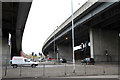
Beneath The Carriageway
Girder bridges carry the A406 North Circular Road and its slip roads over the A118. A roundabout at the top of the slope gives access to and from the A406. Photo taken from Ilford Hill.
Image: © Martin Addison
Taken: 17 Nov 2010
0.07 miles
2
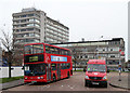
Chapel Road Bus Terminus
Located on the corner of Chapel Road and Roden Street, it is currently the terminus for the 296, 396 and (Tuesdays only) 958 routes. Here we see a Transport for London Incident Response van and a 396 bus on the stands. The 396 is an Alexander bodied Dennis Trident on this occasion, but the route is operated by single deck vehicles as well. Behind is BT's Mill House on Ilford Hill.
Image: © Martin Addison
Taken: 17 Nov 2010
0.08 miles
3
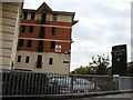
Caxton Place, Ilford
At the end of Ilford Hill, just before the on-slip onto the nearby A406, is a rather modern-looking set of tower blocks called Caxton Place, overlooking the River Roding, which flows under the road just behind the Caxton Place sign. View taken looking south-south east towards the A406.
Image: © Robert Lamb
Taken: 25 Oct 2008
0.08 miles
4
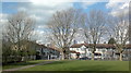
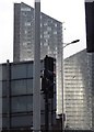
View of Mill House and the Icon Building from the park on Lowbrook Road, Ilford
Looking north-northwest.
Image: © Robert Lamb
Taken: 24 Feb 2014
0.09 miles
6
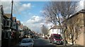
View of Mill House and the Icon Building from Riverdene Road
Mill House is BT's office block, whilst the Icon building houses London St Andrew's College. Both buildings are on Ilford Hill. Looking north-northwest.
Image: © Robert Lamb
Taken: 24 Feb 2014
0.09 miles
7
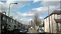
View of the Icon Building from Agnes Avenue
Looking north-northwest.
Image: © Robert Lamb
Taken: 24 Feb 2014
0.09 miles
8
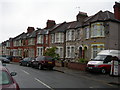
Britannia Road, Ilford
The houses are the standard type for the area.
Image: © Danny P Robinson
Taken: 13 May 2007
0.10 miles
9
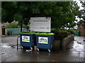
Recycling Site, Audrey Road, Ilford
This kerbside mini recycling site is on Ilford Lane, at the end of Audrey Road.
Image: © Danny P Robinson
Taken: 13 May 2007
0.10 miles
10
Pioneer Point Tower
What was Pioneer Market is now Pioneer Point Tower. It is comprised of social care and private apartments, Hotel, Gym, Global Foods Restaurant and Driving Theory Test centre.
The roundabout is known as Winston Way Roundabout with an underpass.
Image: © Gita Patel
Taken: 16 Dec 2021
0.10 miles