Caxton Place, Ilford
Introduction
The photograph on this page of Caxton Place, Ilford by Robert Lamb as part of the Geograph project.
The Geograph project started in 2005 with the aim of publishing, organising and preserving representative images for every square kilometre of Great Britain, Ireland and the Isle of Man.

There are currently over 7.5m images from over 14,400 individuals and you can help contribute to the project by visiting https://www.geograph.org.uk
Caxton Place, Ilford
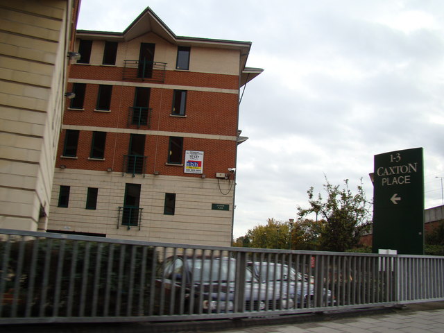
Image: © Robert Lamb Taken: 25 Oct 2008
At the end of Ilford Hill, just before the on-slip onto the nearby A406, is a rather modern-looking set of tower blocks called Caxton Place, overlooking the River Roding, which flows under the road just behind the Caxton Place sign. View taken looking south-south east towards the A406.
Images are licensed for reuse under creativecommons.org/licenses/by-sa/2.0
Image Location
Latitude
51.556651
Longitude
0.066682