IMAGES TAKEN NEAR TO
Upton Bishop, ROSS-ON-WYE, HR9 7QS
Introduction
This page details the photographs taken nearby to HR9 7QS by members of the Geograph project.
The Geograph project started in 2005 with the aim of publishing, organising and preserving representative images for every square kilometre of Great Britain, Ireland and the Isle of Man.

There are currently over 7.5m images from over14,400 individuals and you can help contribute to the project by visiting https://www.geograph.org.uk
Image Map (Loading...)


Getting Data...Please wait
Leaflet Map data © OpenStreetMap
Images are licensed for reuse under creativecommons.org/licenses/by-sa/2.0
Notes
- Clicking on the map will re-center to the selected point.
- The higher the marker number, the further away the image location is from the centre of the postcode.
Image Listing (11 Images Found)
Images are licensed for reuse under creativecommons.org/licenses/by-sa/2.0
Image
Details
Distance
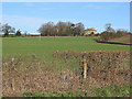
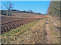
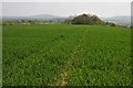
2
Public footpath to Perrystone Hill
Heading north across the field to the top of the hill in the trees. The considerate farmer here has left a strip in cultivation for walkers.
Part of the excellent Herefordshire Trail - http://www.herefordshiretrail.com/
Image: © Trevor Rickard
Taken: 7 Mar 2010
0.11 miles
3
Fine view of May Hill
Looking south-south-east from Perrystone Hill.
Image: © Jonathan Billinger
Taken: 1 Aug 2008
0.13 miles
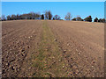
4
Arable field on Perrystone Hill
Looking east to the Malvern Hills on the horizon.
Image: © Trevor Rickard
Taken: 7 Mar 2010
0.14 miles
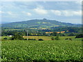
5
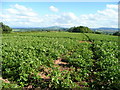
Potato field on Perrystone Hill
Looking south over Coldborough Park.
In the distance is May Hill, centre, with the Cotswold scarp, left, and the edge of the Forest of Dean, right.
Image: © Jonathan Billinger
Taken: 1 Aug 2008
0.14 miles
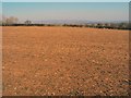
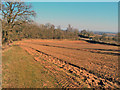
6
Arable land at Coldborough Park Farm
Looking north-west to Perrystone Hill.
Image: © Trevor Rickard
Taken: 7 Mar 2010
0.16 miles
7
Arable land at Coldborough Park Farm
View eastwards with the A449 bordering the bottom of the field on the right.
Image: © Trevor Rickard
Taken: 7 Mar 2010
0.16 miles
8
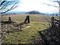
Entrance to a field on Perrystone Hill
Looking south across a field which straddles the top of the hill. May Hill in the distance on the left.
Image: © Trevor Rickard
Taken: 7 Mar 2010
0.17 miles
9
View south from Perrystone Hill
View to the south and May Hill from Perrystone Hill.
Image: © Philip Halling
Taken: 25 Apr 2011
0.18 miles
10
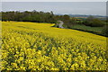
Oil Seed Rape Field
View to the north-east from the Herefordshire Trail near Coldborough Park Farm. The road is the A449 and on the horizon are the Malvern Hills
Image: © Philip Halling
Taken: 7 May 2006
0.20 miles