IMAGES TAKEN NEAR TO
Kiln Road, TRING, HP23 6LT

Introduction

This page details the photographs taken nearby to Kiln Road, HP23 6LT by members of the Geograph project.

The Geograph project started in 2005 with the aim of publishing, organising and preserving representative images for every square kilometre of Great Britain, Ireland and the Isle of Man.

There are currently over 7.5m images from over14,400 individuals and you can help contribute to the project by visiting https://www.geograph.org.uk

Image Map


Images are licensed for reuse under creativecommons.org/licenses/by-sa/2.0
Notes
  • Clicking on the map will re-center to the selected point.
  • The higher the marker number, the further away the image location is from the centre of the postcode.

Image Listing (26 Images Found)

Images are licensed for reuse under creativecommons.org/licenses/by-sa/2.0
  • ...
Image
Details
Distance
1
Glade near Ambers Farm
Taken near the southern boundary of Roundhill Wood next to Ambers Farm.
Image: © Rob Farrow Taken: 16 Jun 2006
0.04 miles
2
Hidden Farm
Ambers Farm is lurking behind the trees and hedge.
Image: © Rob Farrow Taken: 16 Jun 2006
0.04 miles
3
Mossy laneside bank
Kiln Road, which runs between a point near Cholesbury and Image] has High Scrubs on its lefthand side (see Image]) and Roundhill Wood on the right. The mossy bank seen here separates the lane from this latter wood and has various trees sprouting from its ridge.
Image: © Rob Farrow Taken: 6 Apr 2011
0.04 miles
4
Footpath 12 meets Kiln Road
A footpath designated as Number 12 crosses the southeastern section of High Scrubs from Browns Lane to Kiln Road. Here it is seen as it meets the latter lane, the sturdy logs are presumably to prevent motorised access to the wood at this point. The footpath crosses Kiln Lane here and continues into Roundhill Wood on the other side then skirts the northwestern flank of that wood to hit the Chesham Road almost opposite Image]
Image: © Rob Farrow Taken: 29 Sep 2013
0.07 miles
5
Glade in High Scrubs
High Scrubs is a large wood in the Chilterns near Tring. This photo was taken near its southern end, opposite Ambers Farm.
Image: © Rob Farrow Taken: 16 Jun 2006
0.07 miles
6
Kiln Road - Spring beeches
A tunnel of beeches on Kiln Road south of Tring, displaying their bright green spring foliage - rather late this year as the weather had been so appalling in April and early May.
Image: © Rob Farrow Taken: 23 May 2012
0.09 miles
7
High Scrubs, near Ambers Farm
Taken looking over the stile where the (muddy) footpath shown crosses Kiln Lane near Cholesbury.
Image: © Rob Farrow Taken: 15 Jan 2006
0.10 miles
8
High Scrubs path
A footpath is seen snaking into the southern part of High Scrubs, the wood that lies between Kiln Road and Shire Lane, with Browns Lane running through the middle of it. (see Image], Image] & Image])
Image: © Rob Farrow Taken: 6 Apr 2011
0.10 miles
9
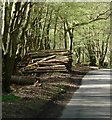
Wood pile on Kiln Road
Three lanes run roughly parallel from near Cholesbury to Image The southwesternmost is Shire Lane (see Image]), the middle one is Image] while the most northeasterly one is Kiln Road seen here. The beeches of the Chilterns probably look their best in their fresh green Spring livery, though the russets of Autumn provide stiff competition !
Image: © Rob Farrow Taken: 6 Apr 2011
0.13 miles
10
Walkers in Roundhill Wood
Public footpath through a beech wood.
Image: © David Hawgood Taken: 1 May 2011
0.15 miles
  • ...