IMAGES TAKEN NEAR TO
Mill Lane, AYLESBURY, HP22 4PL
Introduction
This page details the photographs taken nearby to Mill Lane, HP22 4PL by members of the Geograph project.
The Geograph project started in 2005 with the aim of publishing, organising and preserving representative images for every square kilometre of Great Britain, Ireland and the Isle of Man.

There are currently over 7.5m images from over14,400 individuals and you can help contribute to the project by visiting https://www.geograph.org.uk
Image Map
Images are licensed for reuse under creativecommons.org/licenses/by-sa/2.0
Notes
- Clicking on the map will re-center to the selected point.
- The higher the marker number, the further away the image location is from the centre of the postcode.
Image Listing (100 Images Found)
Images are licensed for reuse under creativecommons.org/licenses/by-sa/2.0
Image
Details
Distance
1
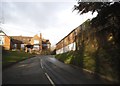
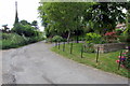
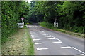
Entering Wingrave
Climbing the hill into Wingrave from the South
Image: © Chris Cole
Taken: 24 Jan 2006
0.04 miles
4
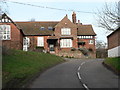
Floyds Farm house, Mill Lane, Wingrave
A grade II listed building, original parts 16th - 17th century.
Image: © Robin Webster
Taken: 5 Jun 2014
0.07 miles
6
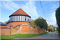
Round Tower in Wingrave
Unusual architecture on the corner of Mill Lane.
Image: © Des Blenkinsopp
Taken: 29 Oct 2019
0.08 miles
7
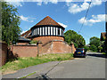
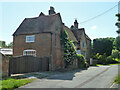
'Barn, Wall and Gate Piers Opposite Floyds Farmhouse'
A grade II listed group, which seems to have once been part of the outbuildings of The Manor, now called Mount Tabor House.
Image: © Robin Webster
Taken: 5 Jun 2014
0.08 miles
8
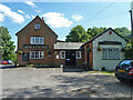
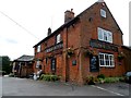
The Rose and Crown, Wingrave
A grade II listed building, the oldest part, on the left, is originally 17th century. A more attractive aspect than this end view may be had from off to the left.
Image: © Robin Webster
Taken: 5 Jun 2014
0.11 miles
10
The Rose and Crown pub, Wingrave
Originally built in C17 but altered since. See http://www.britishlistedbuildings.co.uk/en-350866-the-rose-and-crown-wingrave-with-rowsham
Image: © Bikeboy
Taken: 21 Aug 2014
0.11 miles