IMAGES TAKEN NEAR TO
Lightridge Road, HUDDERSFIELD, HD2 2HF
Introduction
This page details the photographs taken nearby to Lightridge Road, HD2 2HF by members of the Geograph project.
The Geograph project started in 2005 with the aim of publishing, organising and preserving representative images for every square kilometre of Great Britain, Ireland and the Isle of Man.

There are currently over 7.5m images from over14,400 individuals and you can help contribute to the project by visiting https://www.geograph.org.uk
Image Map (Loading...)


Getting Data...Please wait
Leaflet Map data © OpenStreetMap
Images are licensed for reuse under creativecommons.org/licenses/by-sa/2.0
Notes
- Clicking on the map will re-center to the selected point.
- The higher the marker number, the further away the image location is from the centre of the postcode.
Image Listing (60 Images Found)
Images are licensed for reuse under creativecommons.org/licenses/by-sa/2.0
Image
Details
Distance
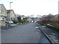
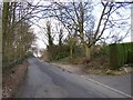
1
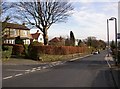
Lightridge Road, Fixby
This is the part below the junction with Broomfield Road.
Image: © Humphrey Bolton
Taken: 8 Mar 2007
0.04 miles
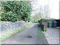
2
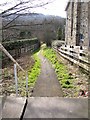
Footpath off Lightridge Road, Fixby
This continues the line of Broomfield Road (which was originally a footpath) down to Cowcliffe Road.
Image: © Humphrey Bolton
Taken: 8 Mar 2007
0.04 miles
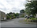
3
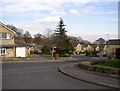
The Fairway, Fixby
This is the winding spine road of the development between Lightridge Road and Upper Fell Greave, near to the junction with Broomfield Road.
Image: © Humphrey Bolton
Taken: 8 Mar 2007
0.06 miles
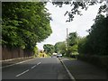
7
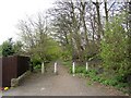
Jilly Royd Lane, Fixby
Seen here from where it is crossed by 'The Fairway'. Bollards to stop use by cars.
Image: © Humphrey Bolton
Taken: 28 Apr 2006
0.10 miles
8
Oakdean - looking towards The Fairway
Image: © Betty Longbottom
Taken: 1 Apr 2014
0.10 miles
9
Cowcliffe Road, Fixby
This is the northern end of the road, dropping steeply from Lightridge Road towards the ford. The waste land on the right has a planning application for flats. It is not quite vacant as there is an electricity sub-station, hidden by the ivy-covered trees in this view.
Image: © Humphrey Bolton
Taken: 8 Mar 2007
0.11 miles
10
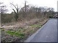
Building plot, Lightridge Road, Fixby
This has been a triangle of waste land, between Lightridge Road and Cowcliffe Road, for many years, but now there is a planning notice for a block of four flats.
Image: © Humphrey Bolton
Taken: 8 Mar 2007
0.11 miles