IMAGES TAKEN NEAR TO
New North Road, HUDDERSFIELD, HD1 5ND
Introduction
This page details the photographs taken nearby to New North Road, HD1 5ND by members of the Geograph project.
The Geograph project started in 2005 with the aim of publishing, organising and preserving representative images for every square kilometre of Great Britain, Ireland and the Isle of Man.

There are currently over 7.5m images from over14,400 individuals and you can help contribute to the project by visiting https://www.geograph.org.uk
Image Map
Images are licensed for reuse under creativecommons.org/licenses/by-sa/2.0
Notes
- Clicking on the map will re-center to the selected point.
- The higher the marker number, the further away the image location is from the centre of the postcode.
Image Listing (114 Images Found)
Images are licensed for reuse under creativecommons.org/licenses/by-sa/2.0
Image
Details
Distance
1
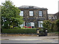
Huddersfield Orthodontics
86 New North Road.
Image: © Jaggery
Taken: 26 Sep 2009
0.02 miles
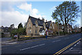
3
Kinder Castle Day Nursery - New North Road
Image: © Betty Longbottom
Taken: 13 May 2008
0.04 miles
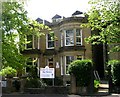
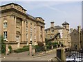
5
Cambridge Guest House, Huddersfield
86 New North Road.
Image: © Jaggery
Taken: 26 Sep 2009
0.07 miles
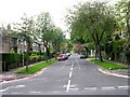
6
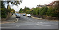
Cedar Avenue, Huddersfield
Viewed from New North Road at the Cemetery Road junction.
Image: © Jaggery
Taken: 26 Sep 2009
0.07 miles
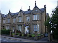
7
Highfields Court, New North Road, Huddersfield
This is the magnificent building on the left, built in Late Classical style as a Congregational Chapel in 1843-4. To the right, down the narrow lane (highfields Road), is a theatre in a building that looks like a mill-owner's house but is captioned 'Sunday School' on the 1907 OS map. On the far right is part of Huddersfield College.
Image: © Humphrey Bolton
Taken: 8 Jun 2007
0.08 miles
9
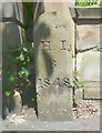
Huddersfield Improvement Act boundary stone, New North Road
The 1850 six-inch map shows the initail boundary of the area as a circle, ignoring topographical features, and this stone seems to be on this circle and is dated 1848. The early 1:2500 maps, from 1889 show a rather different detailed hatched-line boundary that follows property boundaries. I believe that this is a later Improvement Act boundary, but it is not explained in the key.
Image: © Humphrey Bolton
Taken: 6 Jun 2013
0.08 miles
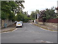
10
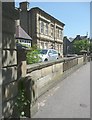
Location of Huddersfield Improvement Act boundary stone, New North Road
Image: © Humphrey Bolton
Taken: 6 Jun 2013
0.08 miles