
IMAGES TAKEN NEAR TO
The Fairway, NORTHWOOD, HA6 3DY
Introduction
This page details the photographs taken nearby to The Fairway, HA6 3DY by members of the Geograph project.
The Geograph project started in 2005 with the aim of publishing, organising and preserving representative images for every square kilometre of Great Britain, Ireland and the Isle of Man.

There are currently over 7.5m images from over14,400 individuals and you can help contribute to the project by visiting https://www.geograph.org.uk
Image Map
Images are licensed for reuse under creativecommons.org/licenses/by-sa/2.0
Notes
- Clicking on the map will re-center to the selected point.
- The higher the marker number, the further away the image location is from the centre of the postcode.
Image Listing (35 Images Found)
Images are licensed for reuse under creativecommons.org/licenses/by-sa/2.0
Image
Details
Distance
1
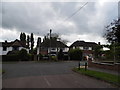
Bishops Avenue at the junction of Crofters Road
Image: © David Howard
Taken: 30 Aug 2012
0.11 miles
2
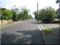
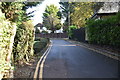
Eastbury: Westbury Road
Yes this is Westbury Road in Eastbury...
The Ordnance Survey's 1:50,000 scale mapping shows a series of solid red circles along this road, meaning that it is an "Other route with public access (not normally shown in urban areas)". On the Ordnance Survey's 1:25,000 scale maps the same symbol is used but in solid green. Perhaps the road is historically a private one, but one for which there is a public right of way. There is certainly nothing to differentiate it from any other road.
The houses on the left are probably at the very limit of the built-up area of London. On the right is The Fairway.
Image: © Nigel Cox
Taken: 28 Jun 2009
0.14 miles
3
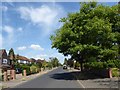
Westbury Road
Westbury Road is immediately to the south of Sandy Lodge Golf Course and leads away from where the London LOOP passes under the Metropolitan line.
Image: © Marathon
Taken: 25 Jul 2018
0.14 miles
4
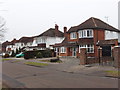
Bourne End Road, Eastbury, Northwood
Photo looking north up the road.
Image: © David Hawgood
Taken: 3 Feb 2006
0.14 miles
5
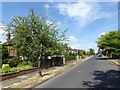
Westbury Road
Westbury Road is immediately to the south of Sandy Lodge Golf Course and leads away from where the London LOOP passes under the Metropolitan line.
Image: © Marathon
Taken: 25 Jul 2018
0.15 miles
6
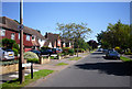
Westbury Road, Eastbury
This is the Southern end of Westbury Road in Eastbury near Northwood.
Image: © Des Blenkinsopp
Taken: 23 Jul 2012
0.16 miles
8
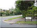
Bourne End Road at the junction of Batchworth Lane
Image: © David Howard
Taken: 30 Aug 2012
0.17 miles
10
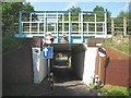
Eastbury: Westbury Road railway bridge
This tiny bridge allows cars, and nothing much bigger, to pass between Eastbury and Moor Park which is beyond the bridge. There has always been an historic right of way through here, long before the Moor Park estate was built and long before suburban Eastbury was built. In fact the bridge dates from around 1887 when the Metropolitan Railway extended their line from Pinner to Rickmansworth and the existing right of way had to be accommodated. Today it is the point at which the approximate 240 kilometre (or about 150 mile) long London Loop long distance footpath crosses the railway.
Image: © Nigel Cox
Taken: 28 Jun 2009
0.20 miles