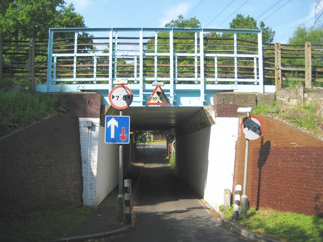
Eastbury: Westbury Road railway bridge
Introduction
The photograph on this page of Eastbury: Westbury Road railway bridge by Nigel Cox as part of the Geograph project.
The Geograph project started in 2005 with the aim of publishing, organising and preserving representative images for every square kilometre of Great Britain, Ireland and the Isle of Man.
There are currently over 7.5m images from over 14,400 individuals and you can help contribute to the project by visiting https://www.geograph.org.uk

Image: © Nigel Cox Taken: 28 Jun 2009
This tiny bridge allows cars, and nothing much bigger, to pass between Eastbury and Moor Park which is beyond the bridge. There has always been an historic right of way through here, long before the Moor Park estate was built and long before suburban Eastbury was built. In fact the bridge dates from around 1887 when the Metropolitan Railway extended their line from Pinner to Rickmansworth and the existing right of way had to be accommodated. Today it is the point at which the approximate 240 kilometre (or about 150 mile) long London Loop long distance footpath crosses the railway.
Image Location


