IMAGES TAKEN NEAR TO
Lincoln Road, NORTHWOOD, HA6 1LD
Introduction
This page details the photographs taken nearby to Lincoln Road, HA6 1LD by members of the Geograph project.
The Geograph project started in 2005 with the aim of publishing, organising and preserving representative images for every square kilometre of Great Britain, Ireland and the Isle of Man.

There are currently over 7.5m images from over14,400 individuals and you can help contribute to the project by visiting https://www.geograph.org.uk
Image Map
Images are licensed for reuse under creativecommons.org/licenses/by-sa/2.0
Notes
- Clicking on the map will re-center to the selected point.
- The higher the marker number, the further away the image location is from the centre of the postcode.
Image Listing (47 Images Found)
Images are licensed for reuse under creativecommons.org/licenses/by-sa/2.0
Image
Details
Distance
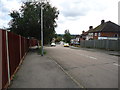
2
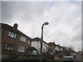
Concrete lamppost on Rochester Road
A closer version
Image: © David Howard
Taken: 2 Dec 2015
0.08 miles
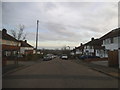
3

Concrete lamppost on Rochester Road
These were standard issue along with the cast iron types till the late 20th century, and are now becoming increasingly rare.
Image: © David Howard
Taken: 2 Dec 2015
0.08 miles
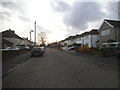
6
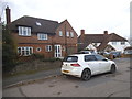
Houses on Cranbourne Road, Northwood Hills
Image: © David Howard
Taken: 2 Dec 2015
0.10 miles
8
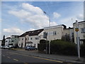
Modernist houses on Norwich Road, Northwood Hills
The pitched rooves were added later, originally they were all flat.
Image: © David Howard
Taken: 17 Jul 2014
0.11 miles
9
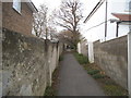
Path from Wiltshire Lane to Chestnut Avenue
The same as the previous one, but a little further along not showing the gates, which appear to make it impossible to access with a wheelchair.
Image: © David Howard
Taken: 2 Dec 2015
0.12 miles
10
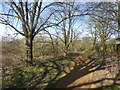
Path on Haste Hill
Haste Hill is part of an open space to the west of Northwood Hills and would be one of the hills after which Northwood Hills is named - see also https://www.geograph.org.uk/photo/5667907 It slopes down to the west to Haste Hill Golf Course and to the south-west to Ruislip Woods National Nature Reserve. Most of the paths are fairly informal although there is one good path which crosses the top of the hill and this can be seen here.
Image: © Marathon
Taken: 21 Mar 2018
0.13 miles