IMAGES TAKEN NEAR TO
Reservoir Road, RUISLIP, HA4 7GN
Introduction
This page details the photographs taken nearby to Reservoir Road, HA4 7GN by members of the Geograph project.
The Geograph project started in 2005 with the aim of publishing, organising and preserving representative images for every square kilometre of Great Britain, Ireland and the Isle of Man.

There are currently over 7.5m images from over14,400 individuals and you can help contribute to the project by visiting https://www.geograph.org.uk
Image Map
Images are licensed for reuse under creativecommons.org/licenses/by-sa/2.0
Notes
- Clicking on the map will re-center to the selected point.
- The higher the marker number, the further away the image location is from the centre of the postcode.
Image Listing (51 Images Found)
Images are licensed for reuse under creativecommons.org/licenses/by-sa/2.0
Image
Details
Distance
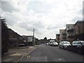
2
Ducks Hill Road at the corner or reservoir Road
Image: © David Howard
Taken: 17 Jul 2014
0.05 miles
3
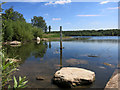
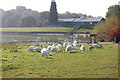
Low Water in the Lido
The lake is not kept filled to capacity due to concerns about flooding, but the mud marks on the gauge board show that it's often higher than this.
Lido history on http://en.wikipedia.org/wiki/Ruislip_Lido
Image: © Des Blenkinsopp
Taken: 16 Jul 2014
0.08 miles
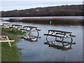
4
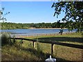
Ruislip Lido
This view shows the beach alongside the dam
The water is for the canal system
Image: © Jack Hill
Taken: 12 Jul 2005
0.08 miles
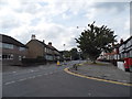
6
Converted Chapel on Ducks Hill Road
Image: © Des Blenkinsopp
Taken: 16 Jul 2014
0.09 miles
8
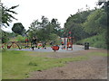
Exercise area at Ruislip Lido
Part of the improvements carried out at the lido since 2010.
Image: © Rod Allday
Taken: 28 Jun 2014
0.10 miles
9
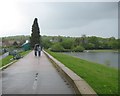
Ruislip Lido dam
A young couple enjoy a wet Sunday afternoon stroll across the dam, which was completed in 1811 to impound a supply of water for the Grand Junction Canal, later the Grand Union Canal. The hamlet of Park Hearn disappeared beneath the subsequent lake. One wonders what if anything is left of it now.
Image: © Nigel Cox
Taken: 16 May 2010
0.10 miles
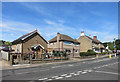
10
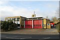
Ruislip fire station
Ruislip fire station, Bury Street, Ruislip, served by London Fire Brigade
Image: © Kevin Hale
Taken: 26 Nov 2007
0.10 miles