IMAGES TAKEN NEAR TO
John Perrin Place, HARROW, HA3 9UR
Introduction
This page details the photographs taken nearby to John Perrin Place, HA3 9UR by members of the Geograph project.
The Geograph project started in 2005 with the aim of publishing, organising and preserving representative images for every square kilometre of Great Britain, Ireland and the Isle of Man.

There are currently over 7.5m images from over14,400 individuals and you can help contribute to the project by visiting https://www.geograph.org.uk
Image Map
Images are licensed for reuse under creativecommons.org/licenses/by-sa/2.0
Notes
- Clicking on the map will re-center to the selected point.
- The higher the marker number, the further away the image location is from the centre of the postcode.
Image Listing (38 Images Found)
Images are licensed for reuse under creativecommons.org/licenses/by-sa/2.0
Image
Details
Distance
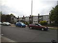
3
Regal way, Kenton
Looking south-west before a bend in the road near Preston Hill
Image: © David Hawgood
Taken: 1 Jan 2006
0.11 miles
5
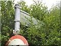
Old footpath sign on Kinch Grove
Unfortunately unless the hedge is cut this will not be fully visible, although it's bound to have the same on the other side which will never be seen except from the garden the other side of it. These are fingerposts so not affected by the 1964 Worboys regulations for the removal of old signs. It says to Ravenscroft Avenue and The Avenue if you look closely.
Image: © David Howard
Taken: 29 Apr 2014
0.12 miles
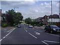
6
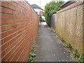
Path from Ravenscroft Avenue to Kinch Grove
Image: © David Howard
Taken: 29 Apr 2014
0.13 miles
7
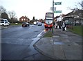
The Mall, Preston
As you can see, the sign points to Preston and The Mall Community Centre, although few people realise that is the official name of the area it is still used from the original buildings here at least.
Image: © David Howard
Taken: 8 Jan 2015
0.13 miles
8
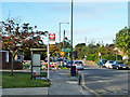
Magnolia Court bus stop
Served by route 79 towards Wembley.
Image: © Robin Webster
Taken: 13 Oct 2012
0.13 miles
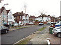
9
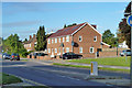
Recent housing, The Mall
Formerly there was a semi-detached pair of houses here similar to those further along, but with a large side garden to the end house.
Image: © Robin Webster
Taken: 13 Oct 2012
0.13 miles
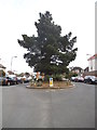
10
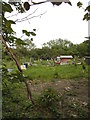
Kinch Allotments, Preston
Although few people are aware of it, the area between Wembley Park and Kenton is called Preston on the map, as illustrated by Preston Road and Preston Hill which cross it.
Image: © David Howard
Taken: 29 Apr 2014
0.13 miles