IMAGES TAKEN NEAR TO
Lancelot Road, WEMBLEY, HA0 2BP
Introduction
This page details the photographs taken nearby to Lancelot Road, HA0 2BP by members of the Geograph project.
The Geograph project started in 2005 with the aim of publishing, organising and preserving representative images for every square kilometre of Great Britain, Ireland and the Isle of Man.

There are currently over 7.5m images from over14,400 individuals and you can help contribute to the project by visiting https://www.geograph.org.uk
Image Map
Images are licensed for reuse under creativecommons.org/licenses/by-sa/2.0
Notes
- Clicking on the map will re-center to the selected point.
- The higher the marker number, the further away the image location is from the centre of the postcode.
Image Listing (165 Images Found)
Images are licensed for reuse under creativecommons.org/licenses/by-sa/2.0
Image
Details
Distance
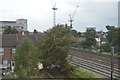
1
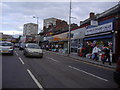
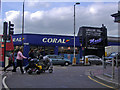
High Road Wembley
Approaching the lights at Ealing Road
Image: © David Howard
Taken: 26 Jan 2010
0.06 miles
4
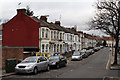
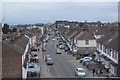
Thurlow Gardens
A side street off Wembley High Road. The closest section of terraced housing dates to around 1900. The housing further along the road appears to have been added after the 1914-18 war. All the housing was present by 1935.
Image: © Martin Addison
Taken: 26 Dec 2011
0.06 miles
5
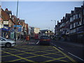
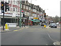
Shops on Wembley High Road opposite Ealing Road
Image: © David Howard
Taken: 20 May 2008
0.07 miles
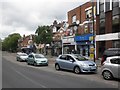
9
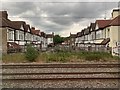
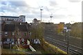
Acacia Avenue, Wembley
From the railway.
Image: © Andrew Abbott
Taken: 5 Jun 2019
0.08 miles