1
Sandhurst High Street
Looking north along the High Street as it exits Sandhurst village with the junction of Lower Church Road on the left.
Image: © Alan Hunt
Taken: 17 Feb 2015
0.06 miles
2
St Michaels School
The gates into the St Michaels Church Of England primary school on Lower Church Road with the church spire in the background.
Image: © Alan Hunt
Taken: 17 Feb 2015
0.06 miles
3
Old houses, Sandhurst village
The junction of Yateley Road with the High Street with two cottages of some antiquity on the corner.
Image: © Alan Hunt
Taken: 17 Feb 2015
0.08 miles
4
Monuments in the churchyard at St Michael, Sandhurst
The one on the left means "a life cut short"; the one second right has recently been vandalised.
Image: © Basher Eyre
Taken: 13 Jul 2015
0.09 miles
5
Lych Gate Close
Image: © Alex McGregor
Taken: 18 Feb 2014
0.10 miles
6
High Street (A321), Sandhurst
Image: © JThomas
Taken: 28 Jul 2022
0.10 miles
7
Monument, St Michael, Sandhurst
In the graveyard of St Michael and All Angels, Sandhurst, stands this monument. Whether it is a monument that has suffered severe damage, or was purposely constructed to demonstrate the frailty of a life cut short, is not obvious.
Image: © Len Williams
Taken: 12 Mar 2014
0.11 miles
8
Lower Church Road, Sandhurst
The southeastern end of the road with the entrance to St Michael's Primary School on the right and the spire of St Michael and all Angels beyond.
Image: © Alan Hunt
Taken: 17 Feb 2015
0.11 miles
9
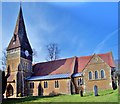
St.Michael's church
Sandhurst parish church by G.E.Street in 1853, enlarged in the 1860s
Image: © Richard Croft
Taken: 14 Sep 2011
0.11 miles
10
St Michael and All Angels, Sandhurst
The first mention of a church, which became St Michael and All Angels, in the scattered hamlet of Sandhurst was in 1220 and for the next 600 years there were few significant changes made to the original building. In 1846, Sandhurst was transferred to the diocese of Oxford. A new incumbent, Henry Parsons, arrived in 1850, and in 1853 he embarked on the first stage of rebuilding. This added a new South aisle, a tower with a spire, and new east and west ends for the nave. The designs were produced by the new diocesan architect, G. E. Street, and some of the interior features, notably the font and pulpit, were executed by the incumbent’s youngest daughter. Twelve years later, a North aisle was added and a larger chancel replaced the last remnant of the original church.
Image: © Len Williams
Taken: 12 Mar 2014
0.11 miles


