
IMAGES TAKEN NEAR TO
Nobleston Estate, ALEXANDRIA, G83 9DF
Introduction
This page details the photographs taken nearby to Nobleston Estate, G83 9DF by members of the Geograph project.
The Geograph project started in 2005 with the aim of publishing, organising and preserving representative images for every square kilometre of Great Britain, Ireland and the Isle of Man.

There are currently over 7.5m images from over14,400 individuals and you can help contribute to the project by visiting https://www.geograph.org.uk
Image Map
Images are licensed for reuse under creativecommons.org/licenses/by-sa/2.0
Notes
- Clicking on the map will re-center to the selected point.
- The higher the marker number, the further away the image location is from the centre of the postcode.
Image Listing (28 Images Found)
Images are licensed for reuse under creativecommons.org/licenses/by-sa/2.0
Image
Details
Distance
1
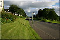
A813 Ladyton Bonhill
View along the A813 at Ladyton Bonhill looking south this is the main route between Balloch and Bonhill to Dumbarton and Glasgow
Image: © George Rankin
Taken: 25 Jun 2007
0.15 miles
2
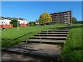
Steps at Ladyton
A housing association is carrying out work on the building at the top of the steps, and on others nearby (out of shot).
Image: © Lairich Rig
Taken: 14 Oct 2018
0.16 miles
3
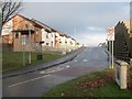
The entrance of St Ronan's (housing estate)
This housing estate in Nobleston, seen here from its entrance, is called St Ronan's, and was built in 2006. However, St Ronan's Primary School, a few hundred metres to the north, pre-dates this estate.
Image: © Lairich Rig
Taken: 28 Nov 2008
0.16 miles
4
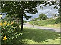
Junction, Bonhill signage
Stirling Road A813 looking north, Junction to Main Street Bonhill left of Bonhill signage, Stirling Road continues northward beyond Bonhill signage. Nobleston Estate on top right of photograph.
Image: © George Rankin
Taken: 6 Aug 2019
0.17 miles
5
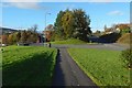
Road junction
Stirling Road is on the right, and Main Street, Bonhill, on the left.
In the left background, Image can be seen indistinctly beside Main Street. The houses on the higher ground at the far right are in Nobleston.
Image: © Lairich Rig
Taken: 29 Oct 2017
0.18 miles
6
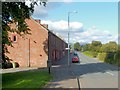
Dillichip Terrace
For more information on this row of buildings, and for different views, see: Image and Image
Behind the hedge on the other side of the main road is a large area of recreation ground.
Image: © Lairich Rig
Taken: 22 Sep 2008
0.20 miles
7
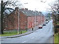
Dillichip Terrace
This long row of two-storey tenement buildings is 1-43 Dillichip Terrace. Dating from 1885, it is one of the few surviving examples (in this area) of housing that was originally built for workers in the local dyeing and printing industry. See also Image and Image
At the time of writing, building number 1 (at the far end) was a shop, but the remainder of the terrace was being used for housing.
Along the front of the terrace, there are several places where an original door has been partially blocked up to form a window, as is clearly evident from the resulting discontinuities in the brickwork. However, for most of them, a much more obvious sign is that the original doorsteps are still there.
As regards the terrace as a whole, compare Image, which is very similar, and which was also built to house local workers.
Image: © Lairich Rig
Taken: 26 Dec 2008
0.20 miles
8
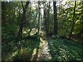
Woods near Nobleston: Croft Huggan
Some of the mist that had filled the Leven and Clyde valleys earlier in the morning lingered here.
The name Croft Huggan is applied to this area of woodland on large-scale mapping. Roy's Military Survey of Scotland (mid-eighteenth century) makes the origin of the name clear: there used to be a farm called Crofthoggan nearby.
Image: © Lairich Rig
Taken: 16 Oct 2015
0.20 miles
9
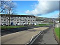
Bonhill, West Dunbartonshire
The Ladyton and O'Hare areas to the north.
Image: © Stephen Sweeney
Taken: 4 Mar 2012
0.20 miles
10
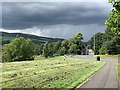
Footpath on the A813 Stirling Road
Footpath on the A813 Stirling Road looking north towards Main Street, Dillichip and Carman Hill on the top left.
Image: © George Rankin
Taken: 6 Aug 2019
0.20 miles