
IMAGES TAKEN NEAR TO
Stoneyflatt Road, DUMBARTON, G82 3BS
Introduction
This page details the photographs taken nearby to Stoneyflatt Road, G82 3BS by members of the Geograph project.
The Geograph project started in 2005 with the aim of publishing, organising and preserving representative images for every square kilometre of Great Britain, Ireland and the Isle of Man.

There are currently over 7.5m images from over14,400 individuals and you can help contribute to the project by visiting https://www.geograph.org.uk
Image Map
Images are licensed for reuse under creativecommons.org/licenses/by-sa/2.0
Notes
- Clicking on the map will re-center to the selected point.
- The higher the marker number, the further away the image location is from the centre of the postcode.
Image Listing (102 Images Found)
Images are licensed for reuse under creativecommons.org/licenses/by-sa/2.0
Image
Details
Distance
1
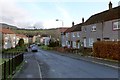
Whiteford Avenue, Bellsmyre
Just ahead, a cul-de-sac branches off to the left; it is also reckoned as part of Whiteford Avenue. It is shown in Image
To the left of the top of the nearest lamp post on the left of the road, it is just possible to pick out a dome as a grey bump on the skyline; it is a Image At the far left in the background is part of Image
Image: © Lairich Rig
Taken: 11 Jan 2013
0.07 miles
2
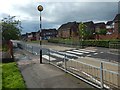
Zebra crossing on Whiteford Avenue
Before the adjacent Aitkenbar Primary School (to the photographer's left) was demolished, this crossing had a dancing lollipop man: Image Most people found that entertaining, but a few complained.
Image: © Lairich Rig
Taken: 14 Sep 2018
0.08 miles
3

Dumbarton Cemetery
This is a general view of the newer northern half of the cemetery. For another such view, and for further comments, see Image
This northern half of the cemetery contains a Image
Image: © Lairich Rig
Taken: 14 Jan 2013
0.09 miles
4
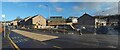
Former site of Aitkenbar Primary School
The view is from the junction of Whiteford Avenue (foreground) and Whiteford Crescent (receding on the right).
Compare Image (with the same zebra crossing visible), and Image (from just beyond that crossing), which were taken, respectively, a year earlier and eight months earlier.
Image: © Lairich Rig
Taken: 25 Nov 2020
0.10 miles
5
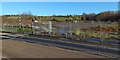
Former site of Aitkenbar Primary School
The crossing at the left is shown from the other side of the road in Image
Housing will be built here. See Image for an earlier picture showing rubble on site, Image for the building that formerly stood here, and Image for its replacement.
Image: © Lairich Rig
Taken: 14 Nov 2019
0.10 miles
6
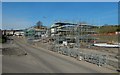
Former site of Aitkenbar Primary School
It is being developed for housing, and it is seen here across Howatshaws Road, at the junction with Whiteford Avenue. See Image for more information and links. For more of the area on the right, see Image
Image: © Lairich Rig
Taken: 22 Mar 2020
0.10 miles
7
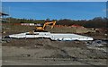
Former site of Aitkenbar Primary School
It was taken on the same day as Image, with some of the same details visible. The site is being developed for housing; see Image for more information and for links.
Image: © Lairich Rig
Taken: 22 Mar 2020
0.10 miles
8
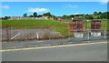
Site of demolished Aitkenbar Primary School
The view is from Whiteford Crescent. The school buildings stood where rubble is now visible at the top of the grassy slope in the left background.
For more information, see Image, which has links to related pictures.
Image: © Lairich Rig
Taken: 17 Jul 2017
0.10 miles
9
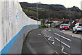
Howatshaws Road
Looking down Howatshaws Road from the new Bellsmyre Campus site towards Aitkenbar Primary School on Whiteford Avenue.
Image: © Matt McFadzean
Taken: 27 Dec 2015
0.11 miles
10
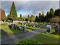
Dumbarton Cemetery
This is a general view of the northern half of the cemetery; for another such view, see Image
This area was not part of the cemetery as it was originally laid out; it was a later extension. This newer northern section has a very different feel about it; the large and varied monuments that are so prevalent in the older part of the cemetery are fascinating and often attractive, but they were of their time. Style and taste have changed, and such structures would be very much out of place here.
Image: © Lairich Rig
Taken: 14 Jan 2013
0.11 miles