
IMAGES TAKEN NEAR TO
Milnwood Crescent, GLASGOW, G71 7UL
Introduction
This page details the photographs taken nearby to Milnwood Crescent, G71 7UL by members of the Geograph project.
The Geograph project started in 2005 with the aim of publishing, organising and preserving representative images for every square kilometre of Great Britain, Ireland and the Isle of Man.

There are currently over 7.5m images from over14,400 individuals and you can help contribute to the project by visiting https://www.geograph.org.uk
Image Map
Images are licensed for reuse under creativecommons.org/licenses/by-sa/2.0
Notes
- Clicking on the map will re-center to the selected point.
- The higher the marker number, the further away the image location is from the centre of the postcode.
Image Listing (47 Images Found)
Images are licensed for reuse under creativecommons.org/licenses/by-sa/2.0
Image
Details
Distance
1
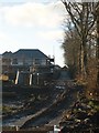
Calderbank Avenue 2008
Compare this with the view www.geograph.org.uk/photo/1474622taken from the same spot only a few years earlier than this. Utter desecration comes to mind.
Image: © Robert Murray
Taken: 28 Nov 2008
0.01 miles
2
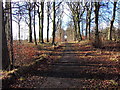
Baillieston, the Calderbank Avenue
The avenue of the old Calderbank House, this view is now history due to a housing developer chopping down one half of the Lime and Beech stands. See www.geograph.org.uk/photo/1474618 to view the change in 2008.
Image: © Robert Murray
Taken: 5 Feb 2005
0.06 miles
3
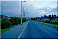
Calderbank Road
Not being a local, I presume this is a fairly new housing estate.
Image: © Malcolm Neal
Taken: 1 Jul 2021
0.06 miles
4
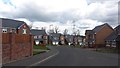
Broomhouse Crescent
New houses just north of the site of Glasgow Zoo. There is a lot of development taking place in this area.
Image: © Richard Webb
Taken: 23 Apr 2012
0.07 miles
5
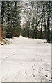
Baillieston, The Avenue, Calderbank
This photo is historical because one side (R.H.) of the avenue has had its trees cut down and destroyed to make room for houses in a housing project.
Image: © Robert Murray
Taken: 27 Jan 2003
0.08 miles
6
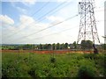
Baillieston, Calderbank
Area now cleared of mature forest which was planted in the 1990s by the Clyde-Calders Project which was managed by the Countryside Commission for Scotland as part of an urban fringe plan of improving the environment and creating opportunities for informal recreation. So much for that then.
Image: © Robert Murray
Taken: 25 Aug 2013
0.11 miles
7
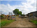
The Hangman's Brae [4]
The entrance to the Calderbank House avenue.
Image: © Robert Murray
Taken: 25 Aug 2013
0.11 miles
8
![Baillieston, Calderbank [2]](https://s2.geograph.org.uk/geophotos/03/62/89/3628914_9d4a9bfd_120x120.jpg)
Baillieston, Calderbank [2]
View towards the site of Calderbank Colliery railway sidings and Ellismuir beyond in the distance. This field has also been cleared of its forest recently. See also Image for background information.
Image: © Robert Murray
Taken: 25 Aug 2013
0.11 miles
9
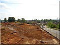
The Hangman's Brae [2]
Ground works which trees were cleared in order to make way for new roundabout. There has been extensive development works on Greenbelt land in this area due to Glasgow city council's determination to see expensive villas dominate the landscape.
Image: © Robert Murray
Taken: 25 Aug 2013
0.12 miles
10
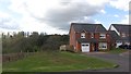
New housing
New housing development off Broomhouse Crescent. There is land awaiting development to the south.
Image: © Richard Webb
Taken: 23 Apr 2012
0.13 miles