
IMAGES TAKEN NEAR TO
Machrie Drive, GLASGOW, G45 0AW
Introduction
This page details the photographs taken nearby to Machrie Drive, G45 0AW by members of the Geograph project.
The Geograph project started in 2005 with the aim of publishing, organising and preserving representative images for every square kilometre of Great Britain, Ireland and the Isle of Man.

There are currently over 7.5m images from over14,400 individuals and you can help contribute to the project by visiting https://www.geograph.org.uk
Image Map
Images are licensed for reuse under creativecommons.org/licenses/by-sa/2.0
Notes
- Clicking on the map will re-center to the selected point.
- The higher the marker number, the further away the image location is from the centre of the postcode.
Image Listing (39 Images Found)
Images are licensed for reuse under creativecommons.org/licenses/by-sa/2.0
Image
Details
Distance
2
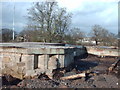
The ruins of Castlemilk House
This was the entrance to Castlemilk House. Recently utilized as a children's play area it is under further development.
Image: © Lynn M Reid
Taken: 7 Mar 2008
0.08 miles
3
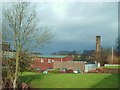
Braeside Primary School
This school is known to older generations as Braeside Primary. It is being utilized by St. Fillans Primary until their new facility is completed.
Image: © Lynn M Reid
Taken: 7 Mar 2008
0.08 miles
4
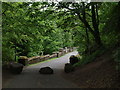
Path onto Castlemilk Bridge
Beside Castlemilk Stables this road heads down among trees to Castlemilk Bridge (Image).
Image: © Alec MacKinnon
Taken: 20 May 2018
0.08 miles
5
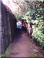
Yew Lined Path
This Path leads to the ruins of Castlemilk House. Local folklore states that Mary Queen of Scots stayed there the night before the Battle of Langside-1568 and planted a Yew tree as a thank you to her hosts The Stuarts of Castlemilk.
Image: © Lynn M Reid
Taken: 7 Mar 2008
0.09 miles
6
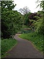
Path into Castlemilk Park
Lots of paths give access to Castlemilk Park from the surrounding residential streets. This one leads to the wee pond near to Castlemilk stables.
Image: © Alec MacKinnon
Taken: 20 May 2018
0.10 miles
7
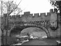
Castlemilk Bridge
Original Bridge was completed around 1833. it originally crossed two ponds now only a small burn flows under it.
Image: © Lynn M Reid
Taken: 7 Mar 2008
0.10 miles
8
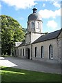
Castlemilk Stables
Built as the stables block for the now demolished Castlemilk House. The building has been recently restored by Elder and Cannon for Glasgow Building Preservation Trust.
Image: © Graeme Yuill
Taken: 18 Sep 2010
0.10 miles
9
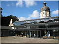
Castlemilk Stables
Stables block for the now demolished Castlemilk House. Recently restored by Elder and Cannon for the Glasgow Building Preservation Trust.
Image: © Graeme Yuill
Taken: 18 Sep 2010
0.10 miles
10
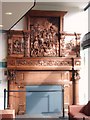
The Castlemilk Fireplace.
This fireplace was created in 1794. It depicts the Battle Of Orleans- 1429, where two Stuart brothers perished. It stands 15ft high and was rescued during the demolition of Castlemilk House in 1969. It was returned to Castlemilk in the early 2000's were it was housed in the CEDA building. It now has pride of place in the recently refurbished Castlemilk Stables.
Image: © Lynn M Reid
Taken: 7 Mar 2008
0.11 miles