
IMAGES TAKEN NEAR TO
Westerlea Court, STIRLING, FK9 4DH
Introduction
This page details the photographs taken nearby to Westerlea Court, FK9 4DH by members of the Geograph project.
The Geograph project started in 2005 with the aim of publishing, organising and preserving representative images for every square kilometre of Great Britain, Ireland and the Isle of Man.

There are currently over 7.5m images from over14,400 individuals and you can help contribute to the project by visiting https://www.geograph.org.uk
Image Map
Images are licensed for reuse under creativecommons.org/licenses/by-sa/2.0
Notes
- Clicking on the map will re-center to the selected point.
- The higher the marker number, the further away the image location is from the centre of the postcode.
Image Listing (14 Images Found)
Images are licensed for reuse under creativecommons.org/licenses/by-sa/2.0
Image
Details
Distance
1
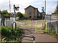
Cycle path at Cornton Road
The cycle/foot path from Causewayhead towards Bridge of Allan meets Cornton Road at its north end here, just next a level crossing.
Image: © Alec MacKinnon
Taken: 20 May 2012
0.11 miles
2
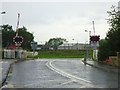
Bridge of Allan, Cornton Road level crossing
A busy one. Up and down like a yo-yo.
Image: © Robert Murray
Taken: 6 Aug 2011
0.11 miles
3
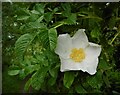
An unexpected rose
Beside a path from the Allan Water to Cornton Road. No doubt an escape from a nearby garden.
Image: © Richard Sutcliffe
Taken: 2 Jun 2022
0.13 miles
4
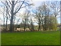
Playing fields beside Cornton Road
As well as the park, there is an area of wetland beside the River Allan.
Image: © Richard Webb
Taken: 25 Mar 2019
0.15 miles
5
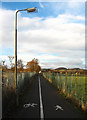
Cycle route
Probably not the most aesthetically pleasing section of cycle route in the area, but widely used by local cyclists.
Image: © William Starkey
Taken: 24 Nov 2010
0.16 miles
6
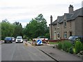
Bridge of Allan
A residential area of Bridge of Allan, just off the road to Cornton and Stirling.
Image: © Richard Webb
Taken: 9 Jul 2005
0.18 miles
7
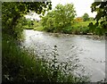
Allan Water
A glimpse downstream through a gap in the riverside trees.
Image: © Richard Sutcliffe
Taken: 2 Jun 2022
0.19 miles
8
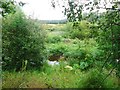
Allan Water
Which can just about be seen through the dense foliage - mainly a severe infestation of Giant Hogweed on both banks. See http://www.invasiveweedsolutions.co.uk/invasive-weed/giant-hogweed?gclid=CNaMw8fCwqoCFQMLfAod6GK67w
Image: © Robert Murray
Taken: 6 Aug 2011
0.20 miles
9

View from NCN 76 near Stirling
A view taken from cycle route NCN76 towards the Ochil Hills, with Dumyat and Castle Law visible in the distance.
Image: © William Starkey
Taken: 24 Nov 2010
0.22 miles
10

Island in Allan Water
With houses in Forth Park behind.
Image: © Andrew Smith
Taken: 14 Jun 2006
0.22 miles