
IMAGES TAKEN NEAR TO
Glebelands, HOLSWORTHY, EX22 6AQ
Introduction
This page details the photographs taken nearby to Glebelands, EX22 6AQ by members of the Geograph project.
The Geograph project started in 2005 with the aim of publishing, organising and preserving representative images for every square kilometre of Great Britain, Ireland and the Isle of Man.

There are currently over 7.5m images from over14,400 individuals and you can help contribute to the project by visiting https://www.geograph.org.uk
Image Map
Images are licensed for reuse under creativecommons.org/licenses/by-sa/2.0
Notes
- Clicking on the map will re-center to the selected point.
- The higher the marker number, the further away the image location is from the centre of the postcode.
Image Listing (75 Images Found)
Images are licensed for reuse under creativecommons.org/licenses/by-sa/2.0
Image
Details
Distance
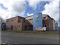
2
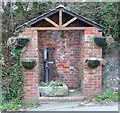
St Mary's Well, Victoria Hill, Holsworthy
Simply captioned 'Pump' on the OS 1:2500 map of 1905.
Image: © Humphrey Bolton
Taken: 6 Apr 2010
0.10 miles
3
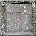
Plaque, Western Road, Holsworthy
This plaque commemorates the opening of Western Road in 1930. This was constructed by the County Council on the line of a narrow footpath called Walk Lane. I should think that its purpose was to enable main road traffic on what is now the A3072 to bypass the market square and the narrow entrance to it from Victoria Square.
Image: © Humphrey Bolton
Taken: 6 Apr 2010
0.11 miles
4
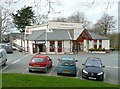
The Memorial Hall, Holsworthy
This opened in 1957 as a war memorial. It looks to have been enlarged in the late 20C style, but has probably retained the original lettering 'Memorial Hall'. The Tourist Information Office is here now, having been previously in the Market Square.
Image: © Humphrey Bolton
Taken: 6 Apr 2010
0.11 miles
5

Holsworthy Community College and its footbridge
The footbridge crosses the A3072
Image: © David Smith
Taken: 14 Apr 2016
0.11 miles
6
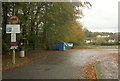
Well Park car park, Holsworthy
With 92 spaces. According to the internet, it costs a flat daily rate of £1, and £32 a month. Err...
Image: © Derek Harper
Taken: 3 Nov 2012
0.12 miles
7

Pump, Holsworthy
On Victoria Hill north of the town centre. It seems to have been repaired since being damaged by vandals four years earlier.
Image: © Derek Harper
Taken: 23 Apr 2016
0.13 miles
8
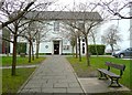
The former Manor House, Holsworthy
This had become the rectory by 1717, and was enlarged twice. The Urban District Council purchased it in 1947 for use as offices. (Information from the town trail booklet)
Image: © Humphrey Bolton
Taken: 6 Apr 2010
0.14 miles
9
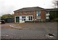
Holsworthy Skills Centre
This is mapped as the Police Station, but I think a swap with a nearby vocational education centre must have taken place a little while ago; this is clearly labelled "Holsworthy Skills Centre", and the Police Station is now elsewhere in Well Park, next to the fire station.
Image: © Derek Harper
Taken: 3 Nov 2012
0.14 miles
10

Texaco filling station, Holsworthy
Shown from the opposite side, and just over a week earlier, in Image The tower of the church peeps above the trees.
Image: © Derek Harper
Taken: 23 Apr 2016
0.14 miles