IMAGES TAKEN NEAR TO
Queenswood Gardens, LONDON, E11 3SE
Introduction
This page details the photographs taken nearby to Queenswood Gardens, E11 3SE by members of the Geograph project.
The Geograph project started in 2005 with the aim of publishing, organising and preserving representative images for every square kilometre of Great Britain, Ireland and the Isle of Man.

There are currently over 7.5m images from over14,400 individuals and you can help contribute to the project by visiting https://www.geograph.org.uk
Image Map
Images are licensed for reuse under creativecommons.org/licenses/by-sa/2.0
Notes
- Clicking on the map will re-center to the selected point.
- The higher the marker number, the further away the image location is from the centre of the postcode.
Image Listing (17 Images Found)
Images are licensed for reuse under creativecommons.org/licenses/by-sa/2.0
Image
Details
Distance
1
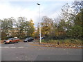
Centre Road at the junction of Aldersbrook Road
The woodland is the edge of Wanstead Flats
Image: © David Howard
Taken: 12 Nov 2017
0.03 miles
3
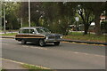
View of a Ford Falcon on Blake Hall Road
Looking south-southwest.
Image: © Robert Lamb
Taken: 27 Sep 2020
0.04 miles
5
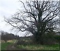
Path to Wanstead Flats (2)
A path leads from Centre Road (past a large tree), towards a large recreational ground beside Aldersbrook Road.
The flats are part of Epping Forest.
Image: © David Anstiss
Taken: 31 Mar 2013
0.12 miles
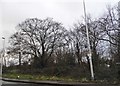
6
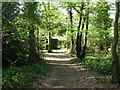
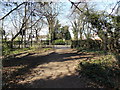
Path in Reservoir Wood
A detached part of the Corporation of London's Epping Forest.
Image: © Robin Webster
Taken: 9 Apr 2011
0.12 miles
7
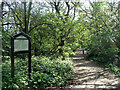
A southern fragment of Epping Forest
This strip of woodland with ponds forms a western approach to Wanstead Park.
Image: © Robin Webster
Taken: 9 Apr 2011
0.13 miles
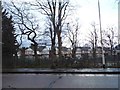
8
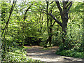
Reservoir Wood
A southern fragment of Epping Forest.
Image: © Robin Webster
Taken: 9 Apr 2011
0.14 miles
9
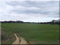
View of a former lake system in Wanstead Park by Blake Hall Road
Looking east.
Image: © Robert Lamb
Taken: 21 Apr 2013
0.14 miles
10
Path to Wanstead Flats
A path leads from Centre Road towards a large recreational ground beside Aldersbrook Road.
The flats are part of Epping Forest.
In the background on the left, the top of Image, can just be seen.
Image: © David Anstiss
Taken: 31 Mar 2013
0.14 miles