IMAGES TAKEN NEAR TO
High Burnham, DONCASTER, DN9 1DD
Introduction
This page details the photographs taken nearby to DN9 1DD by members of the Geograph project.
The Geograph project started in 2005 with the aim of publishing, organising and preserving representative images for every square kilometre of Great Britain, Ireland and the Isle of Man.

There are currently over 7.5m images from over14,400 individuals and you can help contribute to the project by visiting https://www.geograph.org.uk
Image Map
Images are licensed for reuse under creativecommons.org/licenses/by-sa/2.0
Notes
- Clicking on the map will re-center to the selected point.
- The higher the marker number, the further away the image location is from the centre of the postcode.
Image Listing (15 Images Found)
Images are licensed for reuse under creativecommons.org/licenses/by-sa/2.0
Image
Details
Distance
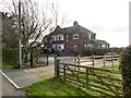
4
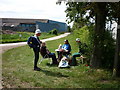
Checkpoint 4, High Burnham Farm
The checkpoint staff talk to the sweepers while we wait for 2 walkers to catch up. This is one of 7 Checkpoints on the 50 mile Peatlands Way from Thorne. The sweepers job is to follow at a distance the last walkers around the course to make sure no one gets lost.
Image: © Ian S
Taken: 21 May 2011
0.11 miles
5
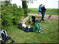
Taking it easy at High Burnham Farm
Checkpoint 4 (21 miles) on the 50 mile Peatlands Way. Here one of the sweepers is having a rest while we wait for 2 backmarkers who somehow got behind us.
Image: © Ian S
Taken: 21 May 2011
0.11 miles
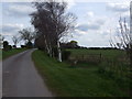
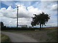
6
The path to High Burnham
High Burnham stands at 41 metres - about as high as it gets in the Isle of Axholme.
Image: © Jonathan Thacker
Taken: 1 Aug 2010
0.12 miles
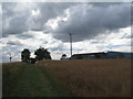
8
Mobile phone mast at High Burnham
High Burnham stands at 41 metres - about as high as it gets in the Isle of Axholme.
Image: © Jonathan Thacker
Taken: 1 Aug 2010
0.13 miles
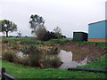
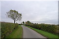
9
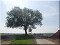
Lone tree at High Burnham farm.
A good viewpoint from the isle of Axholme.
Image: © steven ruffles
Taken: 16 Jul 2013
0.15 miles
10
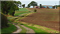
Track leading west towards High Burnham near Haxey
Image: © Colin Park
Taken: 13 Sep 2022
0.17 miles