IMAGES TAKEN NEAR TO
East Lound Road, DONCASTER, DN9 1BB
Introduction
This page details the photographs taken nearby to East Lound Road, DN9 1BB by members of the Geograph project.
The Geograph project started in 2005 with the aim of publishing, organising and preserving representative images for every square kilometre of Great Britain, Ireland and the Isle of Man.

There are currently over 7.5m images from over14,400 individuals and you can help contribute to the project by visiting https://www.geograph.org.uk
Image Map
Images are licensed for reuse under creativecommons.org/licenses/by-sa/2.0
Notes
- Clicking on the map will re-center to the selected point.
- The higher the marker number, the further away the image location is from the centre of the postcode.
Image Listing (9 Images Found)
Images are licensed for reuse under creativecommons.org/licenses/by-sa/2.0
Image
Details
Distance
1
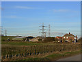
Owston Ferry, Low Hall Farm
There is no apparent evidence for there having been a High Hall. The name probably simply refers to it being at the bottom of the slope visible behind.
Image: © Alan Murray-Rust
Taken: 13 Mar 2011
0.06 miles
2
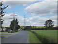
The road to Owston Ferry
This is just past Low Hall Farm along the road to Owston Ferry.
Image: © Marathon
Taken: 8 Sep 2019
0.07 miles
3
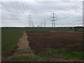
Fields and pylons
Looking south near Low Hall Farm.
Image: © JThomas
Taken: 28 Feb 2015
0.08 miles
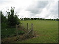
4
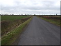
Minor road near Low Hall Farm
Heading west towards East Lound.
Image: © JThomas
Taken: 28 Feb 2015
0.11 miles
6
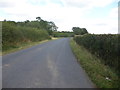
The road to Owston Ferry
This is just past Low Hall Farm along the road to Owston Ferry.
Image: © Marathon
Taken: 8 Sep 2019
0.14 miles
8
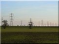
Landscape with power
On the flat landscape of the Trent valley there is no escaping the signs of power generation. The pylons mark one of the main National Grid supply line; in the distance are the cooling towers of West Burton power station.
Image: © Alan Murray-Rust
Taken: 13 Mar 2011
0.21 miles
9
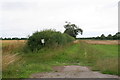
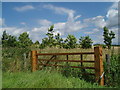
Un-permissive path on East Lound Road
"This Permissive Footpath/bridleway will close on Monday 1st October 2012, permanently".
A salutary reminder of what can happen to Permissive Paths, so don't take them for granted!
Image: © Chris
Taken: 4 Aug 2013
0.22 miles