
IMAGES TAKEN NEAR TO
Annfield Plain, STANLEY, DH9 7XF
Introduction
This page details the photographs taken nearby to DH9 7XF by members of the Geograph project.
The Geograph project started in 2005 with the aim of publishing, organising and preserving representative images for every square kilometre of Great Britain, Ireland and the Isle of Man.

There are currently over 7.5m images from over14,400 individuals and you can help contribute to the project by visiting https://www.geograph.org.uk
Image Map
Images are licensed for reuse under creativecommons.org/licenses/by-sa/2.0
Notes
- Clicking on the map will re-center to the selected point.
- The higher the marker number, the further away the image location is from the centre of the postcode.
Image Listing (31 Images Found)
Images are licensed for reuse under creativecommons.org/licenses/by-sa/2.0
Image
Details
Distance
1
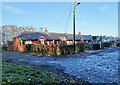
Dodd Terrace, Annfield Plain
This row of bungalows is right at the south end of the village, opposite the Park.
Image: © Robert Graham
Taken: 28 Nov 2022
0.07 miles
2
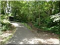
Path junction on the old Consett and Sunderland railway
At this point, a horse stile gives access to the cutting through which the former Consett and Sunderland Railway ran. But the C2C cycle route (National Cycle Network route) which largely follows the course of the railway, here diverges towards a bridge which takes the path over the A693.
Image: © Oliver Dixon
Taken: 11 Jul 2022
0.09 miles
3
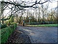
Footpath at the south end of Annfield Plain Park
At the end of Dodd Terrace, this path leads to a footbridge over the bypass.
Image: © Robert Graham
Taken: 28 Nov 2022
0.09 miles
4
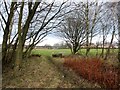
Entrance to playing fields
A short cut from the old railway path onto these playing fields in front of Clavering Place estate at Annfield Plain.
Image: © Robert Graham
Taken: 6 Jan 2020
0.11 miles
5
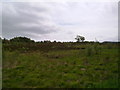
View across the Heath
Looking across Greencroft Heath. Although not a large area, lowland heath is very rare in Co Durham.
Image: © Robert Graham
Taken: 1 Jun 2011
0.11 miles
6
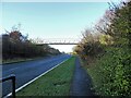
Footbridge over the A693
Bridge over the A693, Annfield Plain Bypass. The path leads into Tower Wood.
Image: © Robert Graham
Taken: 28 Nov 2022
0.12 miles
7
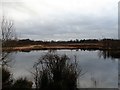
Heathland pond at Greencroft
This is on the nature reserve of Greencroft Heath at Annfield Plain. This is a small surviving area of lowland heath, now a rare habitat in County Durham. This picture shows the pond in winter; it shrinks a lot in the summer.
Image: © Robert Graham
Taken: 6 Jan 2020
0.13 miles
8
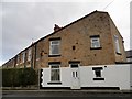
Shaped gable end, Northgate
This is the south end of Northgate Terrace in Annfield Plain. The terraced street joins the cross street at an angle and the house has been continued right to the boundary line, resulting in this interestingly shaped gable end. The street is Edwardian in date, like much of the old village centre.
Image: © Robert Graham
Taken: 6 Jan 2020
0.13 miles
9
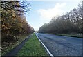
View along the bypass
Looking east along the Annfield bypass at Greencroft. This bypass was built on the A693 in the 1980's. This section cuts through Greencroft Woods.
Image: © Robert Graham
Taken: 28 Nov 2022
0.13 miles
10
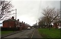
Clavering Place, Annfield Plain
This estate was built in the late 1930's as council housing to replace the streets of old timber miners houses which formerly stood here. It is on the south side of West Road, near the centre of the village. The name commemorates the Clavering family who resided at nearby Greencroft Hall.
Image: © Robert Graham
Taken: 6 Jan 2020
0.14 miles