Shaped gable end, Northgate
Introduction
The photograph on this page of Shaped gable end, Northgate by Robert Graham as part of the Geograph project.
The Geograph project started in 2005 with the aim of publishing, organising and preserving representative images for every square kilometre of Great Britain, Ireland and the Isle of Man.

There are currently over 7.5m images from over 14,400 individuals and you can help contribute to the project by visiting https://www.geograph.org.uk
Shaped gable end, Northgate
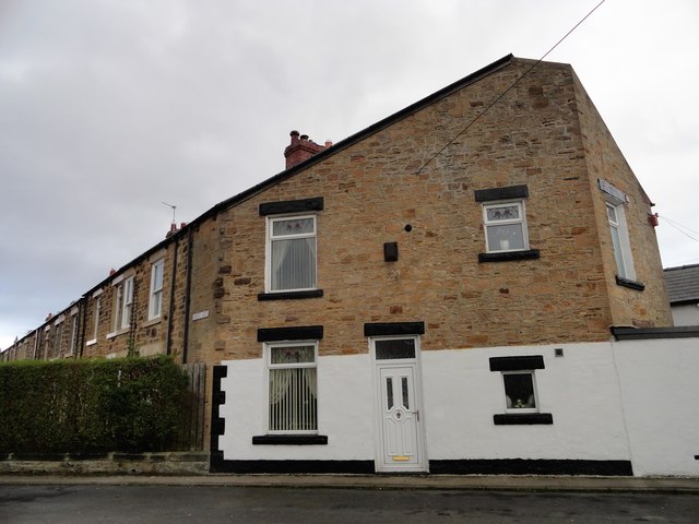
Image: © Robert Graham Taken: 6 Jan 2020
This is the south end of Northgate Terrace in Annfield Plain. The terraced street joins the cross street at an angle and the house has been continued right to the boundary line, resulting in this interestingly shaped gable end. The street is Edwardian in date, like much of the old village centre.
Images are licensed for reuse under creativecommons.org/licenses/by-sa/2.0
Image Location
Latitude
54.856662
Longitude
-1.738591