
IMAGES TAKEN NEAR TO
Kates Gill Grange, STANLEY, DH9 6FH
Introduction
This page details the photographs taken nearby to Kates Gill Grange, DH9 6FH by members of the Geograph project.
The Geograph project started in 2005 with the aim of publishing, organising and preserving representative images for every square kilometre of Great Britain, Ireland and the Isle of Man.

There are currently over 7.5m images from over14,400 individuals and you can help contribute to the project by visiting https://www.geograph.org.uk
Image Map
Images are licensed for reuse under creativecommons.org/licenses/by-sa/2.0
Notes
- Clicking on the map will re-center to the selected point.
- The higher the marker number, the further away the image location is from the centre of the postcode.
Image Listing (11 Images Found)
Images are licensed for reuse under creativecommons.org/licenses/by-sa/2.0
Image
Details
Distance
2
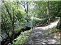
Woodland path in South Stanley
The path through South Stanley Wood crosses the Stanley Burn a couple of times on these little footbridges. The woodland forms a strip running along the burn on the southern edge of the large housing estate at South Stanley.
Image: © Robert Graham
Taken: 12 Aug 2019
0.14 miles
3
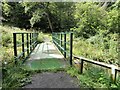
Footbridge in the woods
This is a footbridge over Stanley Burn in South Stanley Wood. The paths here have obviously been tidied up lately, and it was encouraging to see a lack of any obvious vandalism, considering the wood is on the edge of a very large housing estate.
Image: © Robert Graham
Taken: 12 Aug 2019
0.15 miles
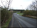
5
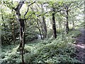
The burn in South Stanley Wood
The wood is a strip of secondary woodland along the banks of the burn. This is known as the Stanley Burn, and becomes the Twizell Burn further on when it reaches Craghead.
Image: © Robert Graham
Taken: 12 Aug 2019
0.19 miles
6
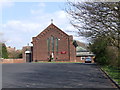
St Mary's Roman Catholic Church, South Stanley
Image: © Peter Gregson
Taken: 7 Apr 2007
0.19 miles
7
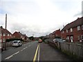
Holly Hill Gardens West
A typical street in this southern part of South Stanley, which was built as council housing in the 1950's. The buses run along this street, as can be seen from the stop on the left.
Image: © Robert Graham
Taken: 12 Aug 2019
0.20 miles
8
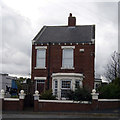
The old Rescue House, Stanley
The old Rescue House originally used as the rescue house for the colliery
Image: © ken canham
Taken: 16 Jun 2019
0.21 miles
9
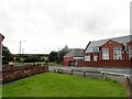
Bottom of Tyne Road, South Stanley
This is the southern end of this road which runs down from Stanley town centre. The road joins Hustledown Road here on the left. The school is St Mary's R C Primary.
Image: © Robert Graham
Taken: 12 Aug 2019
0.21 miles
10
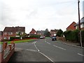
Road junction at Holly Hill Gardens
Junction of the East and West sections. This part of the large South Stanley estate was built in the early 1950's as part of the large programme of council house building undertaken post war. These were excellent houses at the time, and still are.
Image: © Robert Graham
Taken: 12 Aug 2019
0.24 miles