IMAGES TAKEN NEAR TO
DE2 9BP
Introduction
This page details the photographs taken nearby to DE2 9BP by members of the Geograph project.
The Geograph project started in 2005 with the aim of publishing, organising and preserving representative images for every square kilometre of Great Britain, Ireland and the Isle of Man.

There are currently over 7.5m images from over14,400 individuals and you can help contribute to the project by visiting https://www.geograph.org.uk
Image Map
Images are licensed for reuse under creativecommons.org/licenses/by-sa/2.0
Notes
- Clicking on the map will re-center to the selected point.
- The higher the marker number, the further away the image location is from the centre of the postcode.
Image Listing (19 Images Found)
Images are licensed for reuse under creativecommons.org/licenses/by-sa/2.0
Image
Details
Distance
1
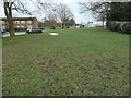
Abandoned mattress, off Penalton Close, Derby
The grassy area is the former route of the Derby Canal.
Image: © Christine Johnstone
Taken: 16 Feb 2023
0.04 miles
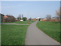
2
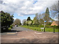
Penalton Close, Allenton
Built over the Derby Canal between Upper Moor Road (foreground) and Harvey Road, to which there is a pedestrian link; it is signposted as part of the canal path.
Image: © Richard Vince
Taken: 4 May 2019
0.06 miles
3
West end of Brackens Lane, Alvaston
Seen from the point at which it once crossed the Derby Canal.
Image: © Richard Vince
Taken: 4 May 2019
0.07 miles
4
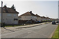
Bracken's Lane, Allenton, Derby
Named after Bracken's Farm which is shown on archived large-scale OS maps.
Image: © Christine Johnstone
Taken: 16 Feb 2023
0.07 miles
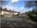
5
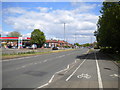
Harvey Road
Harvey Road is part of the outer ring road. This view looks across it to Ashby Street a short cul-de-sac.
Image: © Malcolm Neal
Taken: 8 Apr 2017
0.08 miles
6
Harvey Road entering Alvaston
Part of the Derby ring road, seen from the point at which it crosses the Derby Canal path.
Image: © Richard Vince
Taken: 4 May 2019
0.08 miles
7
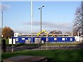
Building a new Aldi
If the Derby Canal ever reopens, this will be a convenient resupplying stop.
Image: © Ian Calderwood
Taken: 3 Dec 2014
0.09 miles
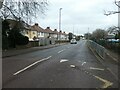
8
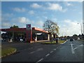
Filling station beside Derby ring road (Harvey Road)
Total filling station accessible to eastbound traffic on the ring road.
Image: © David Smith
Taken: 17 Oct 2012
0.11 miles
9
Cycle Route 6 through Osmaton, Derby
Still following the route of the former Derby Canal
Image: © Tim Heaton
Taken: 22 Mar 2012
0.12 miles
10
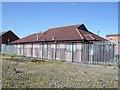
Old Upper Moor Practice
The Meadowfields Practice, Allenton Branch, which used to be the Upper Moor Practice, has relocated to the Coleman Health Centre on Coleman Street. The old building is now up for sale. Judging by the displaced tiles and the hole in the roof, the high fences don't appear to have been much of a deterrent to intruders.
Image: © Ian Calderwood
Taken: 12 May 2012
0.14 miles