
IMAGES TAKEN NEAR TO
Moira Road, SWADLINCOTE, DE12 7QD
Introduction
This page details the photographs taken nearby to Moira Road, DE12 7QD by members of the Geograph project.
The Geograph project started in 2005 with the aim of publishing, organising and preserving representative images for every square kilometre of Great Britain, Ireland and the Isle of Man.

There are currently over 7.5m images from over14,400 individuals and you can help contribute to the project by visiting https://www.geograph.org.uk
Image Map
Images are licensed for reuse under creativecommons.org/licenses/by-sa/2.0
Notes
- Clicking on the map will re-center to the selected point.
- The higher the marker number, the further away the image location is from the centre of the postcode.
Image Listing (30 Images Found)
Images are licensed for reuse under creativecommons.org/licenses/by-sa/2.0
Image
Details
Distance

2

Moira Road, Donisthorpe
Taken from the crossroads between Church Street, Ashby Road and Measham Road. Somewhere along this road was a long line of terraced colliery cottages, since demolished probably due to subsidence and poor living conditions.
The image has been cropped to emphasise the dramatic slopes along this road. This, in addition to the handheld exposure during deep dusk and the f/1.4 aperture of a rather antiquated lens, creates a rather... dreamy image, to put it politely!
Image: © Oliver Mills
Taken: 13 Sep 2021
0.07 miles
3
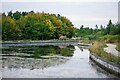
The end of the Ashby Canal (Moira to Donisthorpe)
This isolated stretch of the canal runs from Conkers (Moira) to this point in Donisthorpe, constructed between 1999 and 2005. This will supposedly be extended through Measham and be reconnected to the "real" Ashby canal terminal at Snarestone, finally connecting these few miles of canal to the national network. Despite currently being largely useless for navigation, it is a cherished feature for local walkers and cyclists, acting as a backbone for the Donisthorpe Woodland Park (Dominating the left side of the canal) and the Conkers development.
Image: © Oliver Mills
Taken: 13 Sep 2021
0.07 miles
4
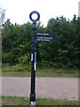
Ashby Canal, Fingerpost
Near the Donisthorpe end of the short navigable, landlocked section of the Ashby Canal.
Inscription: Ashby Canal // Moira Furness // Conkers Waterside / Bath Yard Basin
Milestone Society National ID: LE_SK3114CAN
Image: © Mr Red
Taken: 21 Aug 2021
0.08 miles

6

Ashby Canal, Donisthorpe
The Ashby Canal restored section from Moira terminates at this point for the time being.
Image: © David Kitching
Taken: 5 Jun 2004
0.10 miles

8
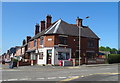
The Village Store, Donisthorpe
On Ashby Road.
Image: © JThomas
Taken: 27 Jun 2019
0.11 miles
9
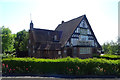
The Masons Arms, Donisthorpe
On Church Street.
Image: © JThomas
Taken: 27 Jun 2019
0.13 miles
10

Sign for the Masons Arms, Donisthorpe
See Image] for context.
Image: © JThomas
Taken: 27 Jun 2019
0.13 miles