
IMAGES TAKEN NEAR TO
Heathfield Road, CREWE, CW3 0HH
Introduction
This page details the photographs taken nearby to Heathfield Road, CW3 0HH by members of the Geograph project.
The Geograph project started in 2005 with the aim of publishing, organising and preserving representative images for every square kilometre of Great Britain, Ireland and the Isle of Man.

There are currently over 7.5m images from over14,400 individuals and you can help contribute to the project by visiting https://www.geograph.org.uk
Image Map
Images are licensed for reuse under creativecommons.org/licenses/by-sa/2.0
Notes
- Clicking on the map will re-center to the selected point.
- The higher the marker number, the further away the image location is from the centre of the postcode.
Image Listing (29 Images Found)
Images are licensed for reuse under creativecommons.org/licenses/by-sa/2.0
Image
Details
Distance
1
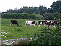
Cows at Little Heath
Cows grazing in a field at Little Heath, Audlem
Image: © Nigel Williams
Taken: 5 Jun 2006
0.04 miles
2
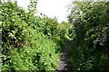
Bridleway near Audlem
Attractive hedged bridleway, the continuation of Mill Lane, Audlem.
Image: © Dave Dunford
Taken: 17 May 2009
0.15 miles
4
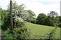
Stream valley near Audlem
From the bridleway at the end of Mill Lane.
Image: © Dave Dunford
Taken: 17 May 2009
0.17 miles
5
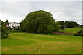
Audlem: Taintree House and Salford, from Woore Road
Taintree House, formerly known as the Manor House, dates back to at least the first half of the eighteenth century, and was the home of the artist Sir James Hamilton Hay in the early twentieth century. (See http://history.audlem.org/med/F57029.jpg for an extract from Marjorie Burton's "Nineteenth Century Audlem", written in 1973, describing the house and artist.) The lane running to the right across the photograph is Salford (that is, Salt Ford, taking its name from one of Cheshire's major exports), which was replaced as the main road east out of the village by the Woore Road turnpike in the first half of the nineteenth century.
Image: © Christopher Hilton
Taken: 31 May 2016
0.17 miles
6
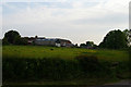
Meadows Farm, Monk's Lane, Audlem
Image: © Christopher Hilton
Taken: 3 Jun 2016
0.18 miles
8
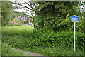
Audlem: Salford
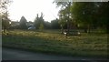
Until the Woore Road turnpike was built in the early 19th century, Salford was the main route east out of Audlem over the valley of Audlem Brook (the houses in the distance are on the far side of the brook). Its name, of course, nods to the importance of the salt industry to Cheshire for centuries.
Image: © Christopher Hilton
Taken: 3 Jun 2016
0.19 miles
9
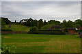
Audlem: Salford, from Woore Road
The lane running across the photograph is Salford (that is, Salt Ford, taking its name from one of Cheshire's major exports), which was replaced as the main road east out of the village by the Woore Road turnpike in the first half of the nineteenth century.
Image: © Christopher Hilton
Taken: 31 May 2016
0.20 miles
10

Former Audlem Primitive Methodist Chapel
Built in 1871 replacing an earlier chapel on the same site. Open for worship until the 1930s when it merged with the Wesleyan Methodist congregation.
Image: © Andrew Abbott
Taken: 25 Jun 2022
0.21 miles