
IMAGES TAKEN NEAR TO
Warrington Lane, COVENTRY, CV6 5SJ
Introduction
This page details the photographs taken nearby to Warrington Lane, CV6 5SJ by members of the Geograph project.
The Geograph project started in 2005 with the aim of publishing, organising and preserving representative images for every square kilometre of Great Britain, Ireland and the Isle of Man.

There are currently over 7.5m images from over14,400 individuals and you can help contribute to the project by visiting https://www.geograph.org.uk
Image Map
Images are licensed for reuse under creativecommons.org/licenses/by-sa/2.0
Notes
- Clicking on the map will re-center to the selected point.
- The higher the marker number, the further away the image location is from the centre of the postcode.
Image Listing (87 Images Found)
Images are licensed for reuse under creativecommons.org/licenses/by-sa/2.0
Image
Details
Distance
1
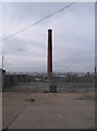
Webster's chimney
The chimney at the old Webster's brick works off Stoney Stanton Road.
Image: © E Gammie
Taken: 11 Mar 2009
0.03 miles
2
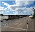
Paragon Park
Located off Stoney Stanton Road is a new development under constructionpers by Persimmon on the site of the former Courtaulds Factory.
Image: © Gerald England
Taken: 24 Sep 2021
0.05 miles
3
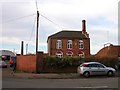
Coventry-Hindu Temple
At the site of the Old Brickworks on Stoney Stanton Road.
Image: © Ian Rob
Taken: 7 Dec 2007
0.06 miles
4
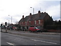
Stoney Stanton Road
A short terrace of houses on Stoney Stanton Road, by the old Webster's brickworks site and opposite the Red Lane junction.
Image: © E Gammie
Taken: 11 Mar 2009
0.06 miles
5
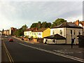
Stoney Stanton Road, Coventry, looking northwards from the canal bridge towards the junction with Red Lane
To the right, just beyond the bridge, can be seen Ordnance Road; the white-painted house on the corner was a post office for many years. The street is now a quiet cul-de-sac, but in the early 20th century it was the approach to the Coventry Ordnance Works, which made a range of weapons including army howitzers and naval guns. The OS 6 inch series map, 1888-1913, shows a mineral line crossing Stoney Stanton Road, just beyond the white house, connecting the factory and the brickworks opposite to the Coventry-Nuneaton railway. https://maps.nls.uk/geo/explore/side-by-side/#zoom=17&lat=52.41909&lon=-1.49801&layers=6&right=OSAPI The ordnance works closed in 1925. https://en.wikipedia.org/wiki/Coventry_Ordnance_Works The row of 6 yellow-painted houses beyond form Coventry Peace House, a housing co-operative active in peace and solidarity work. https://coventrypeacehouse.wixsite.com/coventry-peace-house
Image: © A J Paxton
Taken: 14 Jun 2021
0.08 miles
6
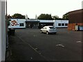
Hindu Temple, Stoney Stanton Road, Foleshill
This is a mandir or temple of the Hindu Temple Society Coventry. A brief but informative history of the temple can be found on its website here https://hindutemplesociety.co.uk/home/brief-history/ . The temple is set well back from the road, behind a car park and behind and alongside the neighbouring Gulf petrol station. The temple's distinctive pair of shikharas, the domed towers, make it visible from the street, however, as does the large orange symbol on the front elevation, which represents the sacred syllable Om that is intoned in prayer and worship.
The temple, at 380 Stoney Stanton Road, opened in 2011 and replaced an earlier temple at no. 274, which has since been demolished; it can be seen on this geograph Image
Image: © A J Paxton
Taken: 26 Aug 2021
0.09 miles
7
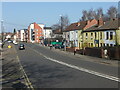
Stoney Stanton Road, Coventry, looking northwards from the canal bridge towards the junction with Red Lane
An older photo than the other one of this title; this one was taken in March 2014. At the corner with Red Lane can just be seen the boarded-up Three Horseshoes pub, which has since become a restaurant. There was a pub of this name here from 1861; much of the building lost its first floor in an air raid in the second world war, leaving the single storey with flat roof that remains. https://www.historiccoventry.co.uk/cph/main/pub.php?pg=three_horse_shoes_stoney_stanton Beyond Red Lane are three and four storey apartments built in the early 21st century on the site of 19th century housing that had fallen into a poor condition. Coventry Peace House occupies the first six houses at the right of the photo, painted yellow with a white dove.
Image: © A J Paxton
Taken: 9 Mar 2014
0.09 miles
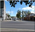
9
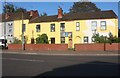
Houses on Stoney Stanton Road, Coventry
Image: © David Howard
Taken: 21 May 2023
0.10 miles
10
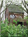
Disused building to the north of Bridge No 4, Coventry Canal
Image: © Keith Williams
Taken: 13 May 2015
0.10 miles