Stoney Stanton Road, Coventry, looking northwards from the canal bridge towards the junction with Red Lane
Introduction
The photograph on this page of Stoney Stanton Road, Coventry, looking northwards from the canal bridge towards the junction with Red Lane by A J Paxton as part of the Geograph project.
The Geograph project started in 2005 with the aim of publishing, organising and preserving representative images for every square kilometre of Great Britain, Ireland and the Isle of Man.

There are currently over 7.5m images from over 14,400 individuals and you can help contribute to the project by visiting https://www.geograph.org.uk
Stoney Stanton Road, Coventry, looking northwards from the canal bridge towards the junction with Red Lane
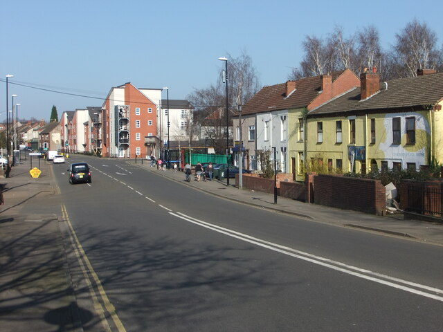
Image: © A J Paxton Taken: 9 Mar 2014
An older photo than the other one of this title; this one was taken in March 2014. At the corner with Red Lane can just be seen the boarded-up Three Horseshoes pub, which has since become a restaurant. There was a pub of this name here from 1861; much of the building lost its first floor in an air raid in the second world war, leaving the single storey with flat roof that remains. https://www.historiccoventry.co.uk/cph/main/pub.php?pg=three_horse_shoes_stoney_stanton Beyond Red Lane are three and four storey apartments built in the early 21st century on the site of 19th century housing that had fallen into a poor condition. Coventry Peace House occupies the first six houses at the right of the photo, painted yellow with a white dove.
Images are licensed for reuse under creativecommons.org/licenses/by-sa/2.0
Image Location
Latitude
52.420521
Longitude
-1.496774