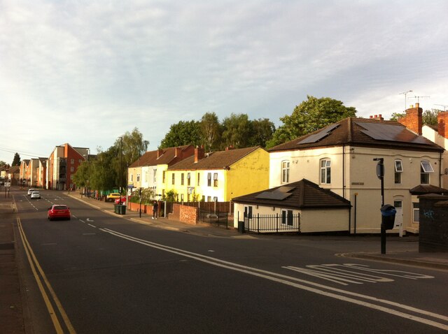
Stoney Stanton Road, Coventry, looking northwards from the canal bridge towards the junction with Red Lane
Introduction
The photograph on this page of Stoney Stanton Road, Coventry, looking northwards from the canal bridge towards the junction with Red Lane by A J Paxton as part of the Geograph project.
The Geograph project started in 2005 with the aim of publishing, organising and preserving representative images for every square kilometre of Great Britain, Ireland and the Isle of Man.
There are currently over 7.5m images from over 14,400 individuals and you can help contribute to the project by visiting https://www.geograph.org.uk

Image: © A J Paxton Taken: 14 Jun 2021
To the right, just beyond the bridge, can be seen Ordnance Road; the white-painted house on the corner was a post office for many years. The street is now a quiet cul-de-sac, but in the early 20th century it was the approach to the Coventry Ordnance Works, which made a range of weapons including army howitzers and naval guns. The OS 6 inch series map, 1888-1913, shows a mineral line crossing Stoney Stanton Road, just beyond the white house, connecting the factory and the brickworks opposite to the Coventry-Nuneaton railway. https://maps.nls.uk/geo/explore/side-by-side/#zoom=17&lat=52.41909&lon=-1.49801&layers=6&right=OSAPI The ordnance works closed in 1925. https://en.wikipedia.org/wiki/Coventry_Ordnance_Works The row of 6 yellow-painted houses beyond form Coventry Peace House, a housing co-operative active in peace and solidarity work. https://coventrypeacehouse.wixsite.com/coventry-peace-house

