
IMAGES TAKEN NEAR TO
Dulverton Avenue, COVENTRY, CV5 8HH
Introduction
This page details the photographs taken nearby to Dulverton Avenue, CV5 8HH by members of the Geograph project.
The Geograph project started in 2005 with the aim of publishing, organising and preserving representative images for every square kilometre of Great Britain, Ireland and the Isle of Man.

There are currently over 7.5m images from over14,400 individuals and you can help contribute to the project by visiting https://www.geograph.org.uk
Image Map
Images are licensed for reuse under creativecommons.org/licenses/by-sa/2.0
Notes
- Clicking on the map will re-center to the selected point.
- The higher the marker number, the further away the image location is from the centre of the postcode.
Image Listing (44 Images Found)
Images are licensed for reuse under creativecommons.org/licenses/by-sa/2.0
Image
Details
Distance
1
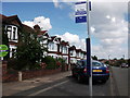
Bus stop, Grayswood Avenue, Whoberley
Halfway between the junctions with Dulverton Avenue and Lincroft Crescent.
Image: © John Brightley
Taken: 31 Aug 2010
0.07 miles
2
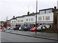
Row of Shops, Grayswood Avenue
At one time all five of these shops would have been supplying goods: groceries green grocer, butcher, hardware and similar supply shops but now none of them do. Service companies have replaced small shop keepers. Two are closed, one is a hair dresser, one is a photographer, one is a maintenance company.
In July 2012 a former local resident wrote:
"Thanks for the somewhat nostalgic but sad photo. I lived and grew up just round the corner in Dulverton Avenue. Your assumptions about the shops past identities are correct. I did part of my Geography O level course work on these shops in the early 1970's they were in decline then. I'm sure it's up in the loft somewhere. One of these was an ironmongers which sold paraffin oils and the like. It had its own special smell. Around November time it had one of the best selection of fireworks around. Almost every empty space would have a bonfire on it.
Thanks for reviving a memory from the past."
Image: © Nigel Mykura
Taken: 4 Mar 2012
0.07 miles
3
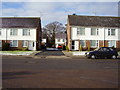
Dulverton Court
Mid 60's infill on a 1930's avenue.
Originally the site was occupied by one single house.
Image: © Anthony Vosper
Taken: 11 Feb 2010
0.07 miles
4
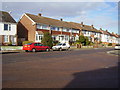
At the top of the hill
Dulverton Avenue, more modern infill in a 1930's avenue, original style houses feature to the right.
Image: © Anthony Vosper
Taken: 11 Feb 2010
0.08 miles
5
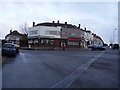
Remember the Post Office?
1930's corner shops. The white fronted building was the local Post Office.
The pillar box is now the only reminder.
Image: © Anthony Vosper
Taken: 12 Feb 2010
0.08 miles
6
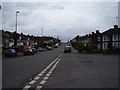
Grayswood Avenue
Looking up hill. In the 1960's both sides of the road were lined with Rowan trees now only a few remain.
Image: © Anthony Vosper
Taken: 28 Apr 2012
0.09 miles
7
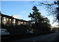
Allesley Old Road
At one time there used to be a drive leading off to the left at the cedar trees which led to a property shown on 1936-7 OS maps as High Field. In the 1960s Image] was built on the site, with access from Dulverton Avenue. Surrounding housing is of ca. 1930s vintage and is set several feet above the road. For many years this road was part of a coach route from London to Holyhead and at this point it climbs a low rise between the River Sherbourne and a tributary stream so it is possible that, in the days before adequate road surfaces, the roadway wore down into a holloway.
Image: © E Gammie
Taken: 18 Dec 2011
0.10 miles
8
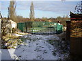
The Green Triangle
Surrounded by Dulverton Avenue, Westbury and Leyland Roads.
This area was originally given over to allotments.
Back in the early '60s the local children would build a huge bonfire for November 5th almost on the site the photograph was taken from.
Image: © Anthony Vosper
Taken: 11 Feb 2010
0.10 miles
10
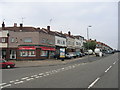
Grayswood Avenue shops, Coventry
A group of shops on the corner of Grayswood Avenue serving this area of pre-WWII housing.
Image: © David Stowell
Taken: 23 Jul 2005
0.12 miles