
IMAGES TAKEN NEAR TO
Myrtle Grove, COVENTRY, CV5 6EZ
Introduction
This page details the photographs taken nearby to Myrtle Grove, CV5 6EZ by members of the Geograph project.
The Geograph project started in 2005 with the aim of publishing, organising and preserving representative images for every square kilometre of Great Britain, Ireland and the Isle of Man.

There are currently over 7.5m images from over14,400 individuals and you can help contribute to the project by visiting https://www.geograph.org.uk
Image Map
Images are licensed for reuse under creativecommons.org/licenses/by-sa/2.0
Notes
- Clicking on the map will re-center to the selected point.
- The higher the marker number, the further away the image location is from the centre of the postcode.
Image Listing (142 Images Found)
Images are licensed for reuse under creativecommons.org/licenses/by-sa/2.0
Image
Details
Distance
1
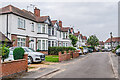
Myrtle Grove
Cul-de-sac extension of Moor Street, first shown on the 1939 25 inch map, suggesting a building date of the 1920s or 1930s.
Image: © Ian Capper
Taken: 25 Sep 2021
0.01 miles
2
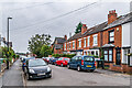
Moor Street
Housing at the north end of Moor Street, with this section first shown with development on the 1906 25 inch map. The house in the background was named Moor Cottage on that map.
Image: © Ian Capper
Taken: 25 Sep 2021
0.05 miles
3
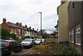
Clarendon Street, Earlsdon
In the foreground the stump is all that remains of a copper beech (visible in Image) felled in April 2011 as it was diseased. The stump is approximately 1m in diameter and it was thought the tree was over 200 years old. The housing in the background shows a variety of styles from the 19th and 20th century.
Image: © E Gammie
Taken: 20 May 2011
0.08 miles
4
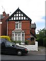
Fairmount, Clarendon Street
A "Watchmaking Heritage Trail 2000" blue plaque on the building reads: "Built in 1895 for Arthur Morgan on his return from America. Foreman at Rotherham's & Sons clock & watch manufacturers"
Image: © E Gammie
Taken: 20 May 2011
0.08 miles
5
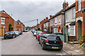
Poplar Road
Early 20th Century housing in a road first shown on the 1913 25 inch Map. IT was named after a house previously on the site, The Poplars.
Image: © Ian Capper
Taken: 25 Sep 2021
0.08 miles
8
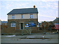
New houses on Clarendon Street
The first of the new houses on this site was nearly complete. See Image for the site before construction, and Image for the previous building here.
Image: © Stephen Craven
Taken: 20 Oct 2012
0.09 miles
9
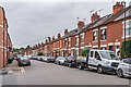
Poplar Road
Early 20th Century housing in a road first shown on the 1913 25 inch Map. IT was named after a house previously on the site, The Poplars.
Image: © Ian Capper
Taken: 25 Sep 2021
0.10 miles
10
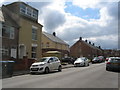
Clarendon Street, Earlsdon
The three blocks beyond the house with a loft extension are part of a new residential development based on the old DBS Showrooms, demolished in 2011 and visible in this 2007 view - Image .
Image: © E Gammie
Taken: 22 Apr 2015
0.10 miles