
IMAGES TAKEN NEAR TO
Gaveston Close, WARWICK, CV34 5HR
Introduction
This page details the photographs taken nearby to Gaveston Close, CV34 5HR by members of the Geograph project.
The Geograph project started in 2005 with the aim of publishing, organising and preserving representative images for every square kilometre of Great Britain, Ireland and the Isle of Man.

There are currently over 7.5m images from over14,400 individuals and you can help contribute to the project by visiting https://www.geograph.org.uk
Image Map
Images are licensed for reuse under creativecommons.org/licenses/by-sa/2.0
Notes
- Clicking on the map will re-center to the selected point.
- The higher the marker number, the further away the image location is from the centre of the postcode.
Image Listing (334 Images Found)
Images are licensed for reuse under creativecommons.org/licenses/by-sa/2.0
Image
Details
Distance
1
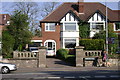
Coventry Road, Warwick
Just over the crest of Cliff Hill these garden walls and gate piers reveal that there was an earlier property on the site, in similar fashion to Image down the road. The splendid mature trees in the area are another clue.
Image: © Robin Stott
Taken: 19 Apr 2009
0.01 miles
2
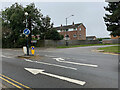
Junction of Coventry Road and Guy's Cross Park Road, Warwick
Nightmare. Coventry Road is in the foreground. Guy's Cross Park Road divides to meet Coventry Road: this is the southern arm. For a driver there is a doubt: is it two-way or one-way? The right-turning arrow suggests the latter. There is no signage. It's worse for a pedestrian: there is no crossing. You reach the little island (not a refuge), then what? Anyone with a pushchair or in a wheelchair would have to wait in the road for a long break in fast traffic to 'safely' cross.
Image: © Robin Stott
Taken: 8 Oct 2021
0.02 miles
3
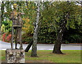
Guy and the Boar
The statue refers to Guy of Warwick. A son of a steward to the Earl of Warwick. He fell in love with the Earl's daughter, but, due to his lowly birth had to prove his valor before he could be considered as her husband. He set off on a series of adventures across the world which included killing a boar at Slough. He is also supposed to have killed a dragon at York.
The statue is by Keith Godwin and was unveiled in 1964.
Image: © Robert Eva
Taken: 28 Oct 2016
0.03 miles
4
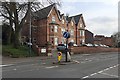
Guy?s Cross Nursing Home, Coventry Road, Warwick
The earliest map at old-maps.co.uk is a 1:500 OS town plan of 1887. This pair of semi-detached mansions are shown and look established though neither are named. The nursing home occupies both. The gable end of dark brick beyond is one of the Fields Court houses. The view is from the island at the junction with Guy's Cross Park Road Image It is not known what or where Guy's Cross is or was.
Image: © Robin Stott
Taken: 9 Apr 2019
0.03 miles
5
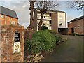
Large property at the end of Fields Court, Warwick
Fields Court is a crisp, clean, secluded, unashamedly modern, well-maintained housing estate developed privately in the early 1960s Image The main access is from Cliffe Way. This house was built as part of the estate but is separate from it; access is from Coventry Road.
Image: © Robin Stott
Taken: 31 Dec 2021
0.04 miles
6
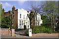
Old houses, Coventry Road, Warwick
The date of these houses, their orientation, their survival - these are all mysteries waiting to be researched.
Image: © Robin Stott
Taken: 19 Apr 2009
0.05 miles
7
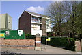
Coventry Road, Warwick
This house was built as part of the Fields Court estate but is separate from it. Image Image
Still looking fresh, this delicious 1960s dish stands out in a street of stale architectural stodge.
Image: © Robin Stott
Taken: 19 Apr 2009
0.05 miles
8
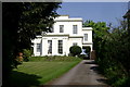
Coventry Road, Warwick
This is the further of the two houses in Image, assumed to be early 19th century, more substantial than appears in that photo, and lucky to survive 20th century attrition on Cliff Hill.
Image: © Robin Stott
Taken: 20 Apr 2009
0.05 miles
9
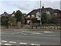
The summit of Cliff Hill, Coventry Road, Warwick
A map of 1938 shows this row of semi-detached houses in outline. Image is a view from 2009. There had formerly been a large villa here called Guy's Cross Hill, at the summit of Cliff Hill. It is not known what or where Guy's Cross is or was. Speculating: a boundary marker with the Guy's Cliffe estate?
Image: © Robin Stott
Taken: 9 Apr 2019
0.05 miles
10
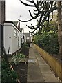
Path to houses, Fields Court, Cliffe Way, Warwick
Image: © Robin Stott
Taken: 2 Jan 2021
0.05 miles