The summit of Cliff Hill, Coventry Road, Warwick
Introduction
The photograph on this page of The summit of Cliff Hill, Coventry Road, Warwick by Robin Stott as part of the Geograph project.
The Geograph project started in 2005 with the aim of publishing, organising and preserving representative images for every square kilometre of Great Britain, Ireland and the Isle of Man.

There are currently over 7.5m images from over 14,400 individuals and you can help contribute to the project by visiting https://www.geograph.org.uk
The summit of Cliff Hill, Coventry Road, Warwick
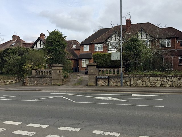
Image: © Robin Stott Taken: 9 Apr 2019
A map of 1938 shows this row of semi-detached houses in outline. Image is a view from 2009. There had formerly been a large villa here called Guy's Cross Hill, at the summit of Cliff Hill. It is not known what or where Guy's Cross is or was. Speculating: a boundary marker with the Guy's Cliffe estate?
Images are licensed for reuse under creativecommons.org/licenses/by-sa/2.0
Image Location
Latitude
52.289852
Longitude
-1.578305