Guy?s Cross Nursing Home, Coventry Road, Warwick
Introduction
The photograph on this page of Guy?s Cross Nursing Home, Coventry Road, Warwick by Robin Stott as part of the Geograph project.
The Geograph project started in 2005 with the aim of publishing, organising and preserving representative images for every square kilometre of Great Britain, Ireland and the Isle of Man.

There are currently over 7.5m images from over 14,400 individuals and you can help contribute to the project by visiting https://www.geograph.org.uk
Guy?s Cross Nursing Home, Coventry Road, Warwick
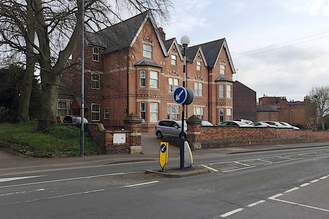
Image: © Robin Stott Taken: 9 Apr 2019
The earliest map at old-maps.co.uk is a 1:500 OS town plan of 1887. This pair of semi-detached mansions are shown and look established though neither are named. The nursing home occupies both. The gable end of dark brick beyond is one of the Fields Court houses. The view is from the island at the junction with Guy's Cross Park Road Image It is not known what or where Guy's Cross is or was.
Images are licensed for reuse under creativecommons.org/licenses/by-sa/2.0
Image Location
Latitude
52.289224
Longitude
-1.578604