
IMAGES TAKEN NEAR TO
Knightlow Avenue, COVENTRY, CV3 3HL
Introduction
This page details the photographs taken nearby to Knightlow Avenue, CV3 3HL by members of the Geograph project.
The Geograph project started in 2005 with the aim of publishing, organising and preserving representative images for every square kilometre of Great Britain, Ireland and the Isle of Man.

There are currently over 7.5m images from over14,400 individuals and you can help contribute to the project by visiting https://www.geograph.org.uk
Image Map
Images are licensed for reuse under creativecommons.org/licenses/by-sa/2.0
Notes
- Clicking on the map will re-center to the selected point.
- The higher the marker number, the further away the image location is from the centre of the postcode.
Image Listing (41 Images Found)
Images are licensed for reuse under creativecommons.org/licenses/by-sa/2.0
Image
Details
Distance
1
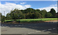
Open land at the corner of Stretton Avenue and Dunsmore Avenue, Willenhall, Coventry
Dunsmore Avenue runs across the picture, climbing left to right. The dense growth of scrub is on a strip of land running back from St James' Lane. A map of 1938 shows a small building on it, identified in 1947 as greenhouses and the land as 'Market Garden'. From the 1950s to the 1970s it is shown as 'Nursery'; a building appears at the front of the site. On a map of 1982 the site is unidentified and by 1992 carries tree symbols. Bollards at the edge of the trees, right, suggest public access.
Image: © Robin Stott
Taken: 5 Oct 2016
0.07 miles
2
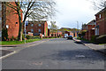
East on Dunsmore Avenue, Willenhall, southeast Coventry
These houses were built on the site of the Chace hostels.
Image: © Robin Stott
Taken: 30 Apr 2016
0.09 miles
3
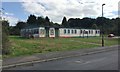
YMCA Willenhall, Stretton Avenue, southeast Coventry
The sign also says 'Part of YMCA Coventry and Warwickshire' https://ymca-cw.org.uk Another sign further along says 'Willenhall Older People's Office' with the logo of Coventry City Council (CCC) Social Services but no building to go with it. Maps of the 1950s show small dwellings here on previously open land – prefabs? In the 1980s and 1990s a building here is 'District Centre' and further along is another labelled 'Clinic'. However, behind the camera is a newer brick building identified as CCC Social Services, and in the village is the new facility seen in Image, so there's been a move around.
Image: © Robin Stott
Taken: 5 Oct 2016
0.11 miles
4
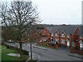
Newer housing on Stretton Avenue, Willenhall, Coventry
Stretton Avenue crosses the photo from left to bottom right. The newer houses in red brick cluster around Wolston Way, which opens onto Stretton Avenue in the middle left of the picture.
Image: © A J Paxton
Taken: 21 Mar 2010
0.14 miles
5
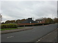
Willenhall, Catholic church
St. Anne's R.C. Church, on the corner of St. James Lane and Dunsmore Avenue. http://www.birminghamdiocese.org.uk/parish_directory_detail.asp?parish=166
Image: © Mike Faherty
Taken: 21 Nov 2010
0.15 miles
6
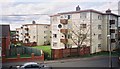
Blocks of flats on Robin Hood Road, Willenhall, Coventry
Viewed from Stretton Avenue.
Image: © A J Paxton
Taken: Unknown
0.16 miles
8

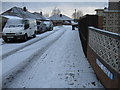
North on Chace Avenue near St Anne's School, Willenhall, Coventry
The houses on the right are part of the residential development on the site of the Chase National Service Hostel built in 1941, later the Chace Hostel. It provided temporary accommodation for homeless people and those seeking permanent homes in the city. In the late 1980s (I'm guessing) residents moved into the Chace Centre on the west side of Chace Avenue as the original site was cleared and developed for housing. The Chace Centre itself is now being demolished.
On the left a fine oak tree comes into leaf, at first a characteristic olive green colour.
Image: © Robin Stott
Taken: 30 Apr 2016
0.17 miles
9
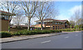
Unidentified building next to Willenhall Police Station, Chace Avenue, Coventry
It looks new, secure and faceless. The downstairs windows are of mirror glass; upstairs windows have vertical blinds drawn: a remand centre, perhaps. On the left of the photo is a corner of Image, occupied by West Midlands Police.
Image: © Robin Stott
Taken: 30 Apr 2016
0.17 miles
10
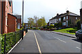
Stretton Avenue, Willenhall, southeast Coventry
On the left are houses that were built on the hostels site.
Image: © Robin Stott
Taken: 30 Apr 2016
0.17 miles