YMCA Willenhall, Stretton Avenue, southeast Coventry
Introduction
The photograph on this page of YMCA Willenhall, Stretton Avenue, southeast Coventry by Robin Stott as part of the Geograph project.
The Geograph project started in 2005 with the aim of publishing, organising and preserving representative images for every square kilometre of Great Britain, Ireland and the Isle of Man.

There are currently over 7.5m images from over 14,400 individuals and you can help contribute to the project by visiting https://www.geograph.org.uk
YMCA Willenhall, Stretton Avenue, southeast Coventry
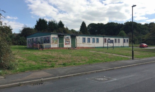
Image: © Robin Stott Taken: 5 Oct 2016
The sign also says 'Part of YMCA Coventry and Warwickshire' https://ymca-cw.org.uk Another sign further along says 'Willenhall Older People's Office' with the logo of Coventry City Council (CCC) Social Services but no building to go with it. Maps of the 1950s show small dwellings here on previously open land – prefabs? In the 1980s and 1990s a building here is 'District Centre' and further along is another labelled 'Clinic'. However, behind the camera is a newer brick building identified as CCC Social Services, and in the village is the new facility seen in Image, so there's been a move around.
Images are licensed for reuse under creativecommons.org/licenses/by-sa/2.0
Image Location
Latitude
52.387212
Longitude
-1.466003